
On June 28, 2025, Joe Miller set out from Lakeview, Oregon, for an 11-day backcountry bicycle tour on the Adventure Route of the Oregon Timber Trail (OTT). 553 miles and 42,400 feet of climbing later, he rode into Hood River, Oregon—battered and beaten, but ecstatic about his experience.
For those of you interested in taking on this epic trail, we’ll be sharing Joe’s story over the coming weeks, which includes his reflections along the way as well as several tips.
Joe Miller is a Board Member of the Oregon Timber Trail Alliance (OTTA), as well as an outdoor advocate and volunteer who has spent the past 30 years exploring the Pacific Northwest backcountry by foot, ski, raft, and bike.
First Things First: The plan, the gear & the getting there
Route and Ride Plan
The route starts in Lakeview, 20 miles from the California border, and meanders through the state, traversing several passes and climate zones until it terminates in Hood River at the Columbia River. My plan was to ride at a party pace, take plenty of breaks, and finish the day early, so I planned to average about 50 miles a day. I didn’t factor in climbing or terrain, but thought that was a reasonable day of riding on gravel roads. Below is my original ride plan, which I stuck with until day 6. In the ride reports below, I recommend variations to each day on how far to ride, where to camp, etc.
| Day # | Start | Start Mile | End | End Mile | Daily Mileage |
|---|---|---|---|---|---|
| 1 | Lakeview | 0.0 | Thomas Creek CG | 52.0 | 52.0 |
| 2 | Thomas Creek CG | 52.0 | Rock Creek Forest Camp | 86.7 | 24.7 |
| 3 | Rock Creek Forest Camp | 86.7 | Thompson Res CG | 137.8 | 51.1 |
| 4 | Thompson Res CG | 137.8 | Chemult | 193.3 | 55.5 |
| 5 | Chemult | 193.3 | North Davis Ck CG | 238.8 | 45.5 |
| 6 | North Davis Ck CG | 238.8 | Three Creeks Lake CG | 294.6 | 55.8 |
| 7 | Three Creeks Lake CG | 294.6 | Big Lake CG | 350.2 | 55.6 |
| 8 | Big Lake CG | 350.2 | Breitenbush | 410.9 | 60.7 |
| 9 | Breitenbush | 410.9 | Paul Dennis CG | 428.0 | 17.1 |
| 10 | Paul Dennis CG | 428.0 | Barlow Crossing CG | 477.8 | 49.8 |
| 11 | Barlow Crossing CG | 477.8 | Hood River | 550 | 72.2 |
I recorded each days ride with Ride w/ GPS, and put my route (mistakes and all) into a collection for reference:
https://ridewithgps.com/collections/5040942
I also put each individual day’s Ride w/ GPS link in the ride reports below.
Getting There
Lakeview is remote and getting there can pose a challenge. I caught a ride with some friends on their way to camp in the Dark Sky Sanctuary that surrounds Lakeview. Three other riders who started on the same day as I arrived by Amtrak in Klamath Falls and got a shuttle from Cedar Keyes from Oregon Territory Outfitters. There are no rental cars or bus service in Lakeview.
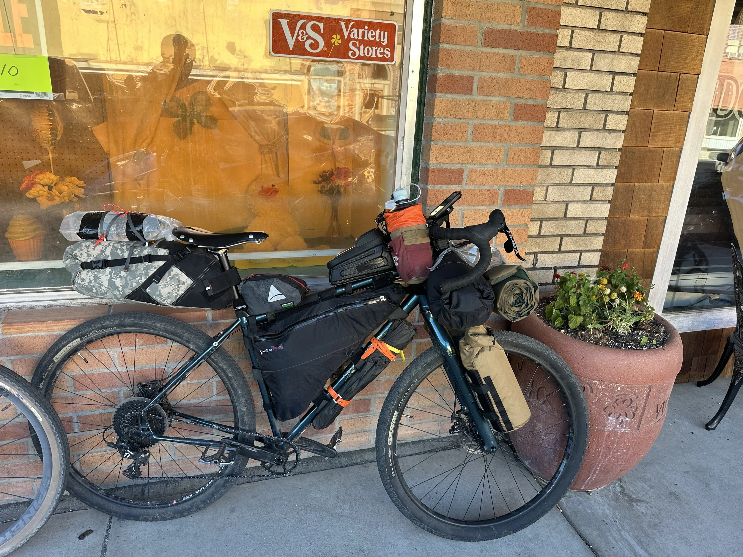
The 2023 steel Salsa Fargo ridden by Joe Miller on the OTT Adventure Route in 2025. Joe was the first OTTA board member to thru ride the new OTT Adventure Route (formerly referred to as the OTT Gravel Route).
The Bike
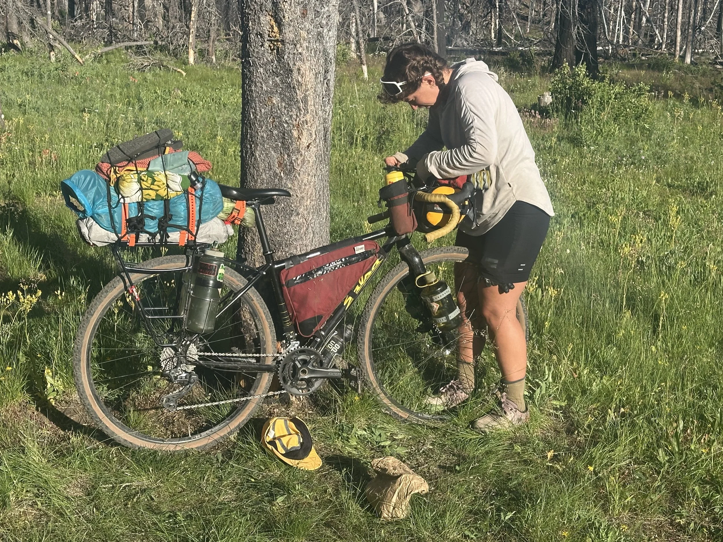
I rode a 2023 steel Salsa Fargo, fully rigid with 2.2-inch tires, loaded heavy for a party pace. The bike performed amazingly well, with no mechanical issues other than a tweaked derailleur hanger that prevented access to my easiest climbing gear and two rivets that vibrated out of my saddle. I also had some brake issues on the last day, but other than those things the bike did great.
In retrospect, this bike was the wrong choice. If I were to do it again I would ride a hardtail mountain bike with 2.1-inch or larger tires; a full suspension mountain bike would not be out of place. The route is rideable on a gravel bike, but you’ll pay for it. A suspended mountain bike will be faster on the technical sections, and your arms will thank you. And pack it light; there are plenty of technical sections to negotiate.
The Technology
I used a Garmin Etrex 1040 Solar cycling computer for navigation and brought my phone with the Ride w/ GPS route loaded as a backup. The Garmin unit was new to me, and I didn’t trust my abilities to use it properly and was really glad I had my phone. Nothing against the Garmin, it worked great and I love it. Make sure you tether your unit to your bike and have a backup. You won’t be able to follow the route without it.
I was surprised at how often I had cell service. It's not consistent enough to be reliable, but I could get out phone calls and texts in a lot of areas, and access Watch Duty and the weather enough to know what was coming up.
As previously mentioned, this route is remote. If you have a mechanical or an injury, you can be out there a long time before anyone passes you. Bring a SPOT or similar emergency communications and let people know of your ride plan ahead of time.
Clothing
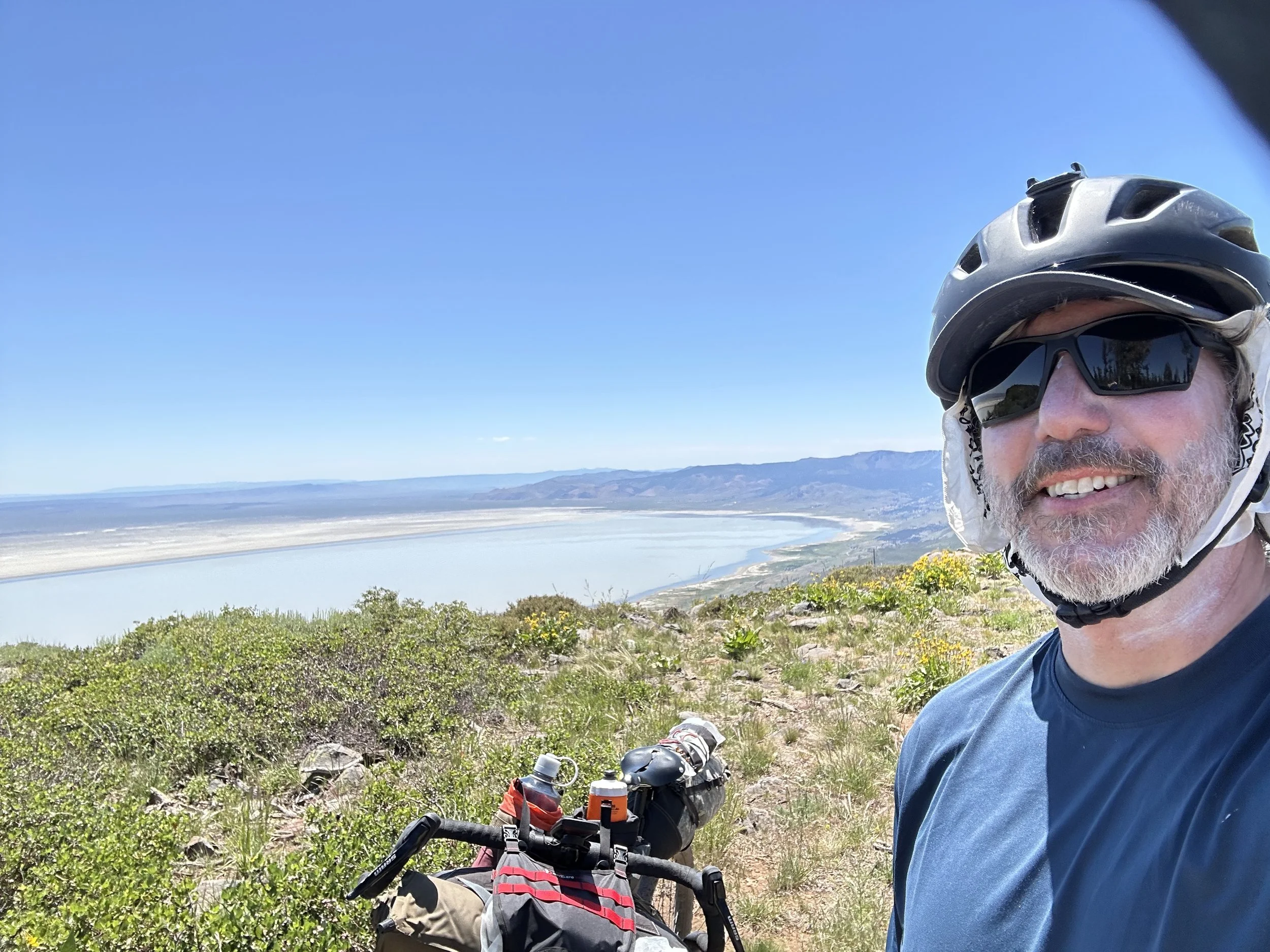
Aside from your everyday riding clothes, bring a puffy, warm pants and rain gear. I never had to use the rain gear, but there were thunderstorms close by on some days, and I could have easily been drenched. The bigger issue was the sun. It was not terribly hot during my ride, but most of the route is exposed to the sun, and heat exhaustion and heat stroke are real possibilities. I was completely covered except for my face, lower legs, and fingertips. I used a sun shirt with a hood and sunscreen under my clothes as a second layer of sun protection. After 11 days exposed to the sun, my face was a bit tan, but I stayed healthily pale otherwise.
Hydration
I had a capacity for about 6 quarts of water and stayed topped off as much as I could. There are a few days when water is scarce, but plan on filling up whenever you can, and you should be fine.
I’m prone to leg cramps and brought powdered electrolytes with me, drinking 4-6 quarts a day, and drinking another 4-6 quarts of straight water on top of the electrolytes. That worked out well for me as I never got a cramp, but it did ruin my taste for electrolytes.
Food
The longest distance between resupply is 200 miles, and the only substantial resupply on the route is in Sisters. Most of the other spots are pretty basic, enough to get you calories but the nutrition is lacking. Here are the resupply points:
| Resupply Waypoint | Description |
|---|---|
| Chemult | Small Market with Basic Sundries and a few groceries |
| Sisters | Lots of Options at Ray’s and other specialty stores |
| Detroit | Small market with basic sundries and a few groceries |
| Olallie Lake Resort (Cash Only!!) | Surprising variety of food, but still pretty basic |
| Parkdale | There’s a nice grocery store here if you need any food for your ride into Hood River |
You can also get some basics at the resort stores along the way, but don’t expect much.
Mountainhouse was kind enough to donate a dozen meals to me, so that is what I mostly ate for the first four days. There are plenty of resources for bikepacking food, so I won’t go into detail here. One trick I picked up from this ride is when bringing Mountainhouse or any hot meal, put each meal in their own Ziplock bags and get rid of the original packaging. It’s pretty bulky and will take up a lot of space in your bag. Then use a one-quart. silicon bag as a “feed bag” to soak your meal. After you eat, simply rinse out the silicone bag, and you can reuse the Ziplock bags for future meals. This will save you a lot of space in your bags as the original packaging is bulky and heavy.
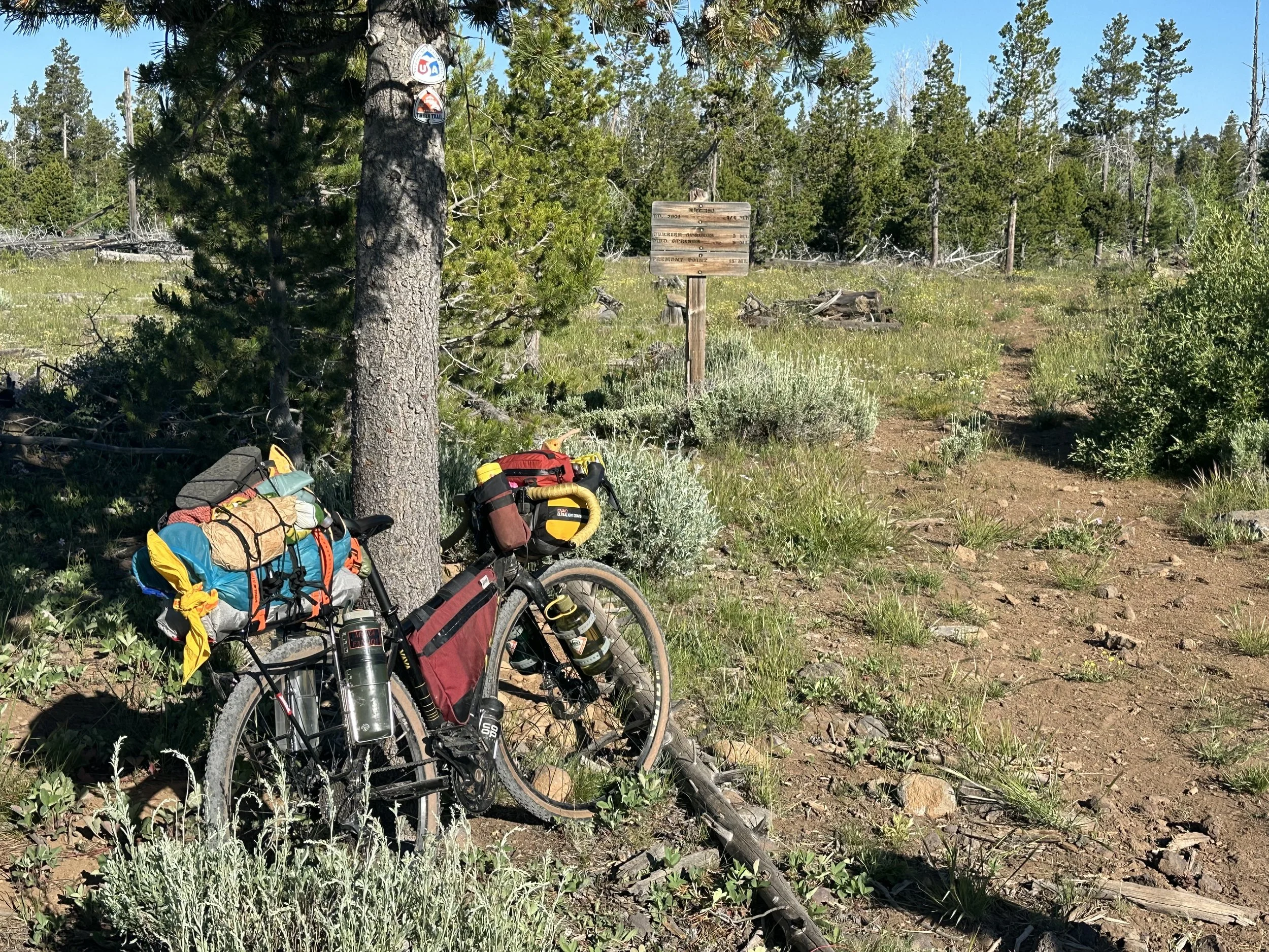
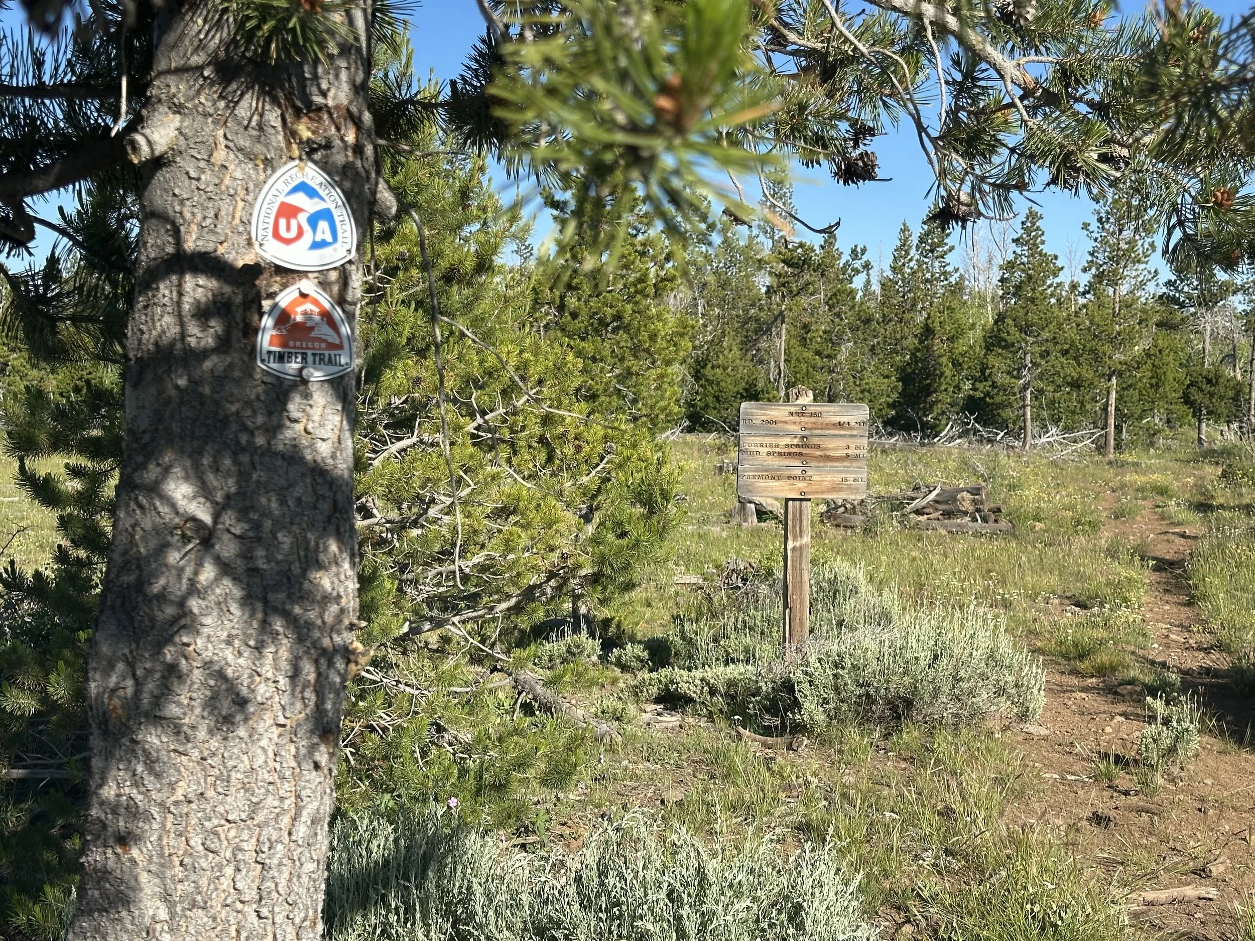
Navigation
The route is straightforward and easy to follow, but keep in mind that just because a line appears on a map, it does not necessarily mean there is an actual road to follow. In several spots, I was just following my GPS, but after a while, the road would reappear. Trust your GPS; you may have to backtrack in some spots to find the route. Be patient and you’ll be fine.
I saved my route each day on Ride with GPS and included a link for each day as well as for the entire ride as a collection. I made several navigation mistakes, more annoying than consequential, and cleaned those up as best I could, but there could still be errors in the route.
Riding Partner
I was fortunate enough to connect with Hanna on the eve of our departure (more on Hanna in the ride reports below). While both of us could have done this ride solo, we were happy to have a riding partner. This area is very remote, with a higher-than-normal risk of equipment or body failure, and no one will come to rescue you for a long time. If you can, do yourself a favor and find a Hanna to ride with; it will make the ride much safer and more memorable.
Pulling It All Together
This is a great route that puts you out into some of the most remote areas of the state, with lots of adventure riding and beautiful scenery. Aside from a few route tweaks, I would not change a thing. Although this version of the OTT is the “gravel” version, don’t let that fool you. Most of my time was spent on surfaces I would classify as “other than gravel.” The length and the elevation gain do not fully convey the difficulty of this ride. You’ll be on singletrack, doubletrack, jeep trails, four-wheeler trails, gravel of various quality, and pavement. While the entire route is rideable, it is hard, with a lot of your time spent on technical climbs and descents. It is most certainly not a traditional gravel ride.
