Signage Volunteer 6
Sep
18
to Sep 22

Signage Volunteer 6

In 2023, thanks to a grant from the Oregon Trails Coalition, the Oregon Timber Trail Alliance (OTTA) embarked on a project to enhance signage along the Oregon Timber Trail. This initiative will improve navigation, particularly in areas impacted by wildfires. If you've tackled the trail before, you know how tricky navigation can be. The OTTA is committed to making the trail more accessible to riders of all skill levels. Better signage will significantly enhance the Oregon Timber Trail experience.

View Event →
Signage Day on Surveyor's Ridge
Sep
14
9:00 AM09:00

Signage Day on Surveyor's Ridge

Join us for a one-day ride/work event on Saturday, September 14 as we place reassurance badges on the iconic Surveyor’s Ridge Trail.


In 2023, thanks to a grant from the Oregon Trails Coalition, the Oregon Timber Trail Alliance (OTTA) embarked on a project to enhance signage along the Oregon Timber Trail. This initiative will improve navigation. If you've tackled the trail before, you know how tricky navigation can be. The OTTA is committed to making the trail more accessible to riders of all skill levels. Better signage will significantly enhance the Oregon Timber Trail experience. Our approach is guided by the principle of installing signs judiciously. Our goal is to strike a balance between providing necessary guidance and preserving the trail's natural beauty.

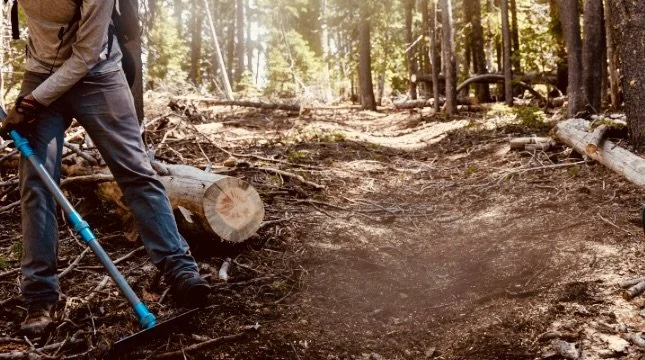
WHAT’S INVOLVED - We’ll be riding the trail by bike, installing reassurance badges, and doing minor trail maintenance as we go. It's hands-on, meaningful work that directly enhances the Oregon Timber Trail for future adventurers. The ride will be 14 miles round trip, with options to do less

WHERE? We’ll meet at the 44 Trails Hub Trailhead (where Super Connector trail crosses Road 17) at 9:00 am

YOU SHOULD BRING - Bring a pack, with water, snacks, mosquito repellant, and sunscreen. We’ll provide the necessary tools.

WEATHER - The forecast calls for 65 degrees and sunny. Bring extra warm layers and outerwear just in case. Mornings can start cool and warm up as the day goes on.

SCHEDULE -We’ll meet at the 44 Trails Hub Trailhead (where Super Connector crosses Road 17) at 9 am. We’ll ride out and back, placing reassurance badges, lopping, and doing some light trimming with hand saws. The ride will be 14 miles round trip, with options to do less

Saturday, September 14 - Trail Ride: 9 am - 4 pm

RSVP

please send a note to: dan.sharp@oregontimbertrail.org

View Event →
Signage Volunteer 5
Sep
5
to Sep 9

Signage Volunteer 5

In 2023, thanks to a grant from the Oregon Trails Coalition, the Oregon Timber Trail Alliance (OTTA) embarked on a project to enhance signage along the Oregon Timber Trail. This initiative will improve navigation, particularly in areas impacted by wildfires. If you've tackled the trail before, you know how tricky navigation can be. The OTTA is committed to making the trail more accessible to riders of all skill levels. Better signage will significantly enhance the Oregon Timber Trail experience.

View Event →
Signage Volunteer 4
Aug
19
to Aug 22

Signage Volunteer 4

In 2023, thanks to a grant from the Oregon Trails Coalition, the Oregon Timber Trail Alliance (OTTA) embarked on a project to enhance signage along the Oregon Timber Trail. This initiative will improve navigation, particularly in areas impacted by wildfires. If you've tackled the trail before, you know how tricky navigation can be. The OTTA is committed to making the trail more accessible to riders of all skill levels. Better signage will significantly enhance the Oregon Timber Trail experience.

View Event →
Signage Volunteer 3
Aug
7
to Aug 11

Signage Volunteer 3

In 2023, thanks to a grant from the Oregon Trails Coalition, the Oregon Timber Trail Alliance (OTTA) embarked on a project to enhance signage along the Oregon Timber Trail. This initiative will improve navigation, particularly in areas impacted by wildfires. If you've tackled the trail before, you know how tricky navigation can be. The OTTA is committed to making the trail more accessible to riders of all skill levels. Better signage will significantly enhance the Oregon Timber Trail experience.

View Event →
Signage Volunteer 2
Jul
23
to Jul 28

Signage Volunteer 2

In 2023, thanks to a grant from the Oregon Trails Coalition, the Oregon Timber Trail Alliance (OTTA) embarked on a project to enhance signage along the Oregon Timber Trail. This initiative will improve navigation, particularly in areas impacted by wildfires. If you've tackled the trail before, you know how tricky navigation can be. The OTTA is committed to making the trail more accessible to riders of all skill levels. Better signage will significantly enhance the Oregon Timber Trail experience.

View Event →
Signage Volunteer 1
Jul
8
to Jul 12

Signage Volunteer 1

In 2023, thanks to a grant from the Oregon Trails Coalition, the Oregon Timber Trail Alliance (OTTA) embarked on a project to enhance signage along the Oregon Timber Trail. This initiative will improve navigation, particularly in areas impacted by wildfires. If you've tackled the trail before, you know how tricky navigation can be. The OTTA is committed to making the trail more accessible to riders of all skill levels. Better signage will significantly enhance the Oregon Timber Trail experience.

View Event →
Fremont Stewardship Event #2
Jul
5
to Jul 7

Fremont Stewardship Event #2

The southernmost 50 miles of the Oregon Timber Trail are challenging. This high-elevation route follows the crest of the Warner Mountains, climbing to 8200 feet at Crane Mountain. It’s a remote area where the trail doesn’t get much use, so following it can be difficult. Many dying trees have fallen over the trail, making sections nearly impassible and forcing riders to lift their bikes over hundreds of logs. This year the Oregon Timber Trail Alliance will partner with the Fremont-Winema National Forest to restore these 50 miles of trail.  The Forest Service will fund two work parties as long as we contribute at least 720 hours of volunteer labor.  That’s where you come in.

View Event →
Intro to Bikepacking: Sisters Workshop
Jun
7
6:00 PM18:00

Intro to Bikepacking: Sisters Workshop

In this bikepack-curious, beginner friendly workshop we’ll give you a little background on the Oregon Timber Trail and go over the basics of how to prepare for your next bikepacking adventure. We’ll cover some of the fundamentals of navigation, planning logistics, packing, snacks & meal planning, and more! The evening will include a  a community discussion to answer any lingering bikepacking questions.

View Event →
Fifteenmile Trail Work Party
Jun
1
9:00 AM09:00

Fifteenmile Trail Work Party

The Fifteenmile trail is a 10-mile-long section of the Stiletsi and White Crane Loop found on the Oregon Timber Trail website. The Fifteenmile trail climbs through an oak savanna studded with yellow balsamroot, past old-growth ponderosa pine, through dense conifer forest, and then tops out at Eightmile Point with some pretty incredible views.  The trail is seldom far from Fifteenmile Creek, which is always good for a cold plunge on a hot day.

View Event →
Fremont Stewardship Event #1
May
24
to May 26

Fremont Stewardship Event #1

The southernmost 50 miles of the Oregon Timber Trail are challenging. This high elevation route follows the crest of the Warner Mountains, climbing to 8200 feet at Crane Mountain. It’s a remote area where the trail doesn’t get much use, so following it can be difficult. Many dying trees have fallen over the trail, making sections nearly impassible and forcing riders to lift their bikes over hundreds of logs. This year the Oregon Timber Trail Alliance will partner with the Fremont-Winema National Forest to restore these 50 miles of trail.  The Forest Service will fund two work parties as long as we contribute at least 720 hours of volunteer labor.  That’s where you come in. OTTA volunteers will donate their muscle and skill to improve trails May 24-26 and again July 5-7.

View Event →
Oct
15
9:00 AM09:00

44 Trails Association - Work Party

Most of the trail system along the Oregon Timber Trail route north of Highway 26 and south of Parkdale is maintained by volunteers with the 44 Trails Mountain Bike Organization. They do a great job at keeping the trails in shape!

This fall they are organizing work parties on the Surveyors Ridge and Dog River trails. The Oregon Timber Trail follows Surveyors Ridge. Please consider joining them on one of their work parties to do your bit.

Join them on Sunday, October 15 for the first fall work day!

Click for Details

View Event →
Jun
29
to Jul 2

Fremont Stewardship Event #3

Photo: Daniel Sharp

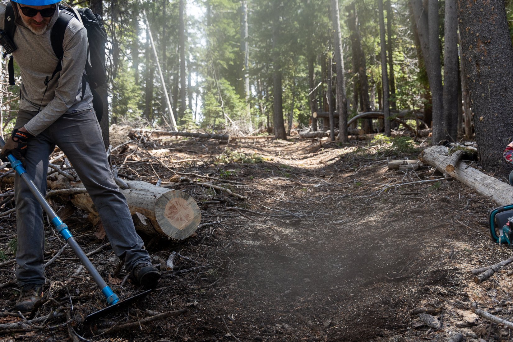
Crane Mountain and the first fifty miles of the Oregon Timber Trail are notoriously challenging. The reasons are many, between the fact that at over 8200 feet, Crane is the high point, a second is the western pine beetle, which weakens and ultimately kills many trees in this zone. All it takes is a strong winter wind storm, and the trail becomes littered with blowdown. Finally, it’s simply a remote section of trail that doesn’t get a large amount of traffic. Our goal is to change that and to have this area become a bit more accessible. Don’t worry, it will always be remote and rugged. Many a rider has made it as far as Lakeview and wondered if the rest of the trail needs this much work. The OTTA, partnered with the Fremont-Winema National Forest and signed a Cost Share Agreement to rehabilitate this part of the Fremont National Recreation Trail. A stipulation of this generous grant is that we invest over 2,000 hours of volunteer labor in the project—that’s where you come in!

Interested in joining us for this event? Please sign up here

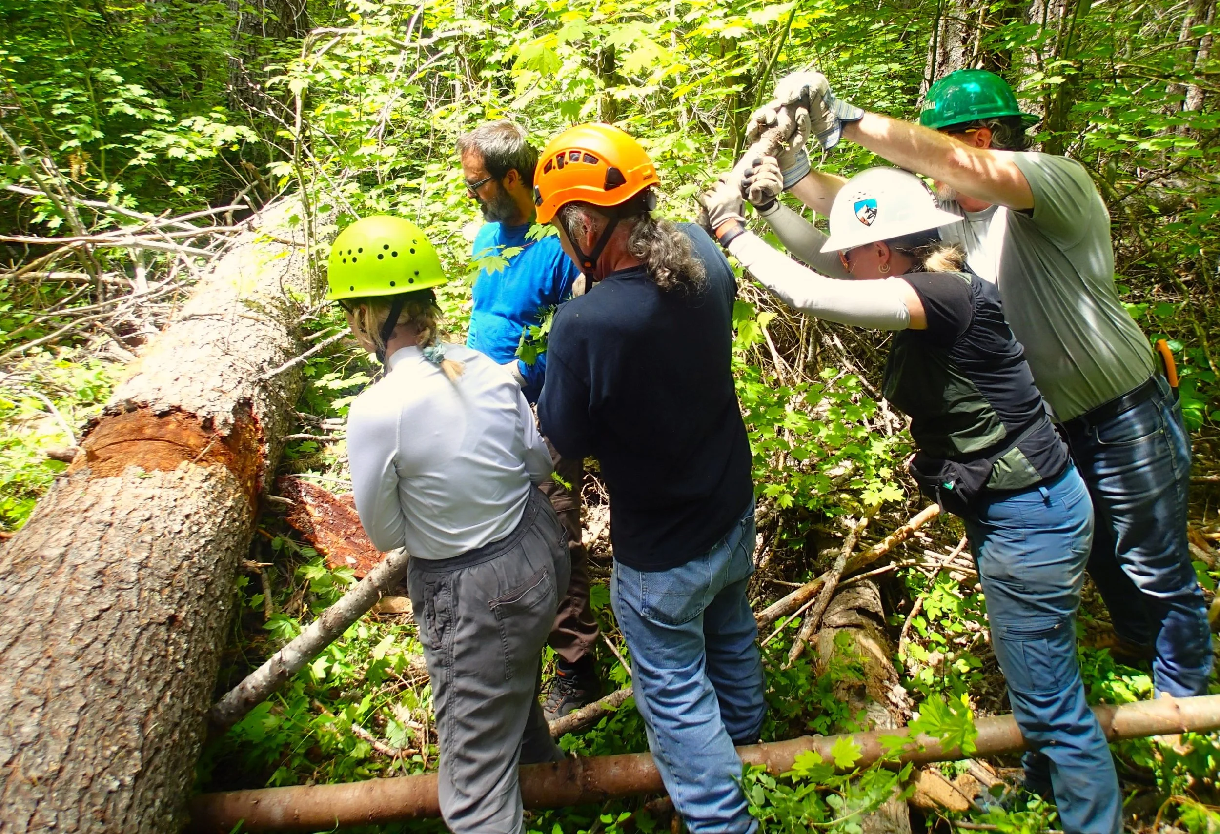
NO EXPERIENCE REQUIRED - Each event will begin with a safety and tool talk and we’ll talk about best tools and techniques for the work ahead. Our goals for this event will be focused primarily on re-establishing trail tread and clearing undergrowth and deadfall along the trail corridor.

SCHEDULE - We'll set up base camp on Thursday evening, and plan on beginning work after breakfast on Friday morning. Expect to put in a solid 8 hours of trail work each day. Sunday will be a partial day—leaving some time for a morning group ride and then we’ll pack up camp. If you can only make it for some of the days please indicate that on your registration.

Thursday, June 29
Travel and Camp setup 4pm

Friday, June 30
Trail work: 9am - 4pm

Saturday, July 1
Trail work: 9am - 4pm

Sunday, July 2

Trail work: 9am - 4pm, Finish up trail work/group ride

GETTING THERE - The roads to base camp will be passable by all passenger vehicles. There is NO cell reception so carry paper maps. It's about a 6 hour drive from Portland. We will announce the specific base camp and work location as they become available.

LOGISTICS - It’s still spring, and we’re camped at 6,000' and working up to 8,000’ so temperatures can be freezing at night and the weather can snow on us and sunburn us all in the same weekend. Come prepared. Drink plenty of water, take breaks, and wear sunscreen. There is no cell service. No potable water is available at the campground. We will have water on hand, but please bring what you need on trail and at camp. We suggest you fill your gas tank in Paisley or Lakeview before you arrive at camp.

MEALS - We will be providing coffee, oatmeal and eggs for breakfast. Dinner will be provided. Please bring what you need for lunch and snacks on trail. Please bring your own reusable plate, bowl, silverware, and drinking vessel.

YOU SHOULD BRING - Tent, sleeping bag, pad, extra toilet paper, lots of water, dishes, and a camp chair. During the work day Personal Protective Equipment (PPE) is required to work on public lands; this includes a 6-point suspension helmet (some loaners provided), eye protection, gloves, long pants, long sleeve shirt, and sturdy shoes/boots. Bring a pack, with water, snacks, mosquito repellant, and sunscreen each day as well. Blister treatment is a great idea too. If you have a large pack or BOB trailer, consider bringing it as the trails are steep and rugged and getting tools to where they're needed can be a challenge. And don't forget your bike riding gear—we'll make sure there's some time to ride if you're not too exhausted at the end of the day.

WEATHER - Nighttime temperatures can be freezing and daytime temps can be hot with no shade or cold, windy, and wet with no shelter. Bring extra warm layers and outerwear just in case.

This is going to be a fun event working, camping, and riding in the Timber Trail’s most intriguing tier. We're excited and grateful that you're spending a valuable summer weekend giving back to our public lands. On behalf of the Oregon Timber Trail Alliance and the Fremont-Winema National Forest, a huge thanks goes out to everyone lending a hand at this stewardship event.
Photo: Daniel Sharp

View Event →
Jun
9
to Jun 11

Fremont Stewardship Event #2

Photo: Daniel Sharp

Crane Mountain and the first fifty miles of the Oregon Timber Trail are notoriously challenging. The reasons are many, between the fact that at over 8200 feet, Crane is the high point, a second is the western pine beetle, which weakens and ultimately kills many trees in this zone. All it takes is a strong winter wind storm, and the trail becomes littered with blowdown. Finally, it’s simply a remote section of trail that doesn’t get a large amount of traffic. Our goal is to change that and to have this area become a bit more accessible. Don’t worry, it will always be remote and rugged. Many a rider has made it as far as Lakeview and wondered if the rest of the trail needs this much work. The OTTA, partnered with the Fremont-Winema National Forest and signed a Cost Share Agreement to rehabilitate this part of the Fremont National Recreation Trail. A stipulation of this generous grant is that we invest over 2,000 hours of volunteer labor in the project—that’s where you come in!

Interested in joining us for this event? Please sign up here

NO EXPERIENCE REQUIRED - Each event will begin with a safety and tool talk and we’ll talk about best tools and techniques for the work ahead. Our goals for this event will be focused primarily on re-establishing trail tread and clearing undergrowth and deadfall along the trail corridor.

SCHEDULE - We'll set up base camp on Thursday evening, and plan on beginning work after breakfast on Friday morning. Expect to put in a solid 8 hours of trail work each day. Monday will be a partial day—leaving some time for a morning group ride and then we’ll pack up camp. If you can only make it for some of the days please indicate that on your registration.

Thursday, June 8
Travel and Camp setup 4pm

Friday, June 9
Trail work: 9am - 4pm

Saturday, June 10
Trail work: 9am - 4pm

Sunday, June 11
Finish Trail work/group ride : 9am - 4pm

GETTING THERE - The roads to base camp will be passable by all passenger vehicles. There is NO cell reception so carry paper maps. It's about a 6 hour drive from Portland. We will announce the specific base camp and work location as they become available.

LOGISTICS - It’s still spring, and we’re camped at 6,000' and working up to 7,000’ so temperatures can be freezing at night and the weather can snow on us and sunburn us all in the same weekend. Come prepared. Drink plenty of water, take breaks, and wear sunscreen. There is no cell service. No potable water is available at the campground. We will have water on hand, but please bring what you need on trail and at camp. We suggest filling up your gas tank in Paisley or Lakeview before you make it to basecamp.

MEALS - Please bring your own reusable plate, bowl, silverware, and drinking vessel. We will be providing coffee and oatmeal for breakfast. Please bring what you need for lunch and dinner.

YOU SHOULD BRING - Tent, sleeping bag, pad, extra toilet paper, lots of water, dishes, and a camp chair. During the work day Personal Protective Equipment (PPE) is required to work on public lands; this includes a 6-point suspension helmet (some loaners provided), eye protection, gloves, long pants, long sleeve shirt, and sturdy shoes/boots. Bring a pack, with water, snacks, mosquito repellant, and sunscreen each day as well. Blister treatment is a great idea too. If you have a large pack or BOB trailer, consider bringing it as the trails are steep and rugged and getting tools to where they're needed can be a challenge. And don't forget your bike riding gear—we'll make sure there's some time to ride if you're not too exhausted at the end of the day.

WEATHER - Nighttime temperatures may be freezing. Day temps can be hot with no shade or cold, windy, and wet with no shelter. Bring extra warm layers and outerwear just in case.

This is going to be a fun event working, camping, and riding in the Timber Trail’s most intriguing tier. We're excited and grateful that you're spending a valuable summer weekend giving back to our public lands. On behalf of the Oregon Timber Trail Alliance and the Fremont-Winema National Forest, a huge thanks goes out to everyone lending a hand at this stewardship event.

Photo: Gabriel Amadeus

View Event →
Jun
3
10:00 AM10:00

National Trails Day Ride

photo: Gritchelle Fallesgon

National Trails Day w/OTTA & COTA 

June 3rd 2023 

Join the Oregon Timber Trail Alliance and the Central Oregon Trail Alliance on June 3, 2023 to celebrate National Trails Day! We'll meet at Cogwild in Bend, Oregon at 10am and decide on the best route for all abilities. We'll begin with some basic bike maintenance for riding trails. We're giving away all kinds of useful biking and bike repair gear (buffs, stickers, repair gloves, aprons, chain lube) When we get back there will be a raffle and beverages to celebrate our day on the trail.

First 20 signups will be guaranteed a bundle of bike maintenance gear from Finishline and 1 piece of OTTA/COTA merch.

Participant must:

  • Be 18 years of age or older or accompanied by an adult

  • have a bike made for and experience riding 5+ miles on non-paved surfaces

  • Be responsible for their own gear, food, and water.

After registering for the event you will receive a confirmation email.

Please click the button below and fill out form to sign up

View Event →
May
26
to May 29

Fremont Stewardship Event #1

Photo: Matt Ruddy

In September of 2021 the Cougar Peak Fire ignited and eventually burned over 90 thousand acres—including one of our most treasured segments of the Fremont Tier: Moss Pass and Cox Pass. Between 2017 and 2022 the Oregon Timber Trail Alliance had spent over 4,000 volunteer hours re-opening and restoring the Fremont National Recreation Trail through this area.

As always, a large hot fire is a tragic and sad event. Yet this area sees a frequent cycle of fire and regeneration—it’s part of how the landscape functions and cleanses. This particular area was clogged with beetle-kill pine logs: a carpet of volatile forest fire tinder.

While it will take many years to resemble its former self, its regrowth is unique and beautiful in its own right. The OTTA, partnered with the Fremont-Winema National Forest and signed a Cost Share Agreement to rehabilitate the most severely burned miles of the Fremont National Recreation Trail. A stipulation of this generous grant is that we invest over 2,000 hours of volunteer labor in the project—that’s where you come in!

Interested in joining us for this event? Please sign up here

NO EXPERIENCE REQUIRED - Each event will begin with a safety and tool talk and we’ll talk about best tools and techniques for the work ahead. Our goals for this event will be focused primarily on re-establishing trail tread and clearing undergrowth and deadfall along the trail corridor.

SCHEDULE - We'll set up base camp on Thursday evening, and plan on beginning work after breakfast on Friday morning. Expect to put in a solid 8 hours of trail work each day. Monday will be a partial day—leaving some time for a morning group ride and then we’ll pack up camp. If you can only make it for some of the days please indicate that on your registration.

Thursday, May 25
Travel and Camp setup 4pm

Friday, May 26
Trail work: 9am - 4pm

Saturday, May 27
Trail work: 9am - 4pm

Sunday, May 28
Trail work: 9am - 4pm

Monday, May 29
Optional morning group ride, Pack up camp

GETTING THERE - The roads to base camp will be passable by all passenger vehicles. There is NO cell reception so carry paper maps. It's about a 6 hour drive from Portland. We will camp here. Driving directions to base camp from Paisley are here. Make sure to fill your gas tank in Summer Lake, or Silver Lake or Lakeview.

DIRECTIONS - From Paisley, turn West on Co Hwy 2-08. You will travel south on OR-31 for 5.9 miles. Turn right onto Clover Flat Rd/County Hwy 2-10A and go 9.1 miles. Slight right onto County Hwy 2-10C/NF-3510 and go 4.7 miles. Slight right and drive another 0.3 miles to camp. We will put up the Oregon Timber Trail sign.

LOGISTICS - It’s still spring, and we’re camped at 6,000' and working up to 7,000’ so temperatures will be quite chilly (freezing) at night and the weather can snow on us and sunburn us all in the same weekend. Come prepared. Drink plenty of water, take breaks, and wear sunscreen. Since we’ll be working in a burn area we will get quite sooty and dirty. Bring extra clothes if you don’t want to look like a chimney sweep each day. There is no cell service. No potable water is available at the campground. We will have water on hand, but please bring what you need on trail and at camp. Camp will be near a creek, so filtering water is an option. Nearest fuel and services are over an hour away in Paisley or Bly. We suggest you fill your gas tank in Silver Lake or Paisley as you travel.

MEALS - Please bring your own reusable plate, bowl, silverware, and drinking vessel. We will be providing coffee, oatmeal and eggs for breakfast. Dinner will be provided. Please bring what you need for lunch and snacks on trail.

YOU SHOULD BRING - Tent, sleeping bag, pad, extra toilet paper, lots of water, dishes, and a camp chair. During the work day Personal Protective Equipment (PPE) is required to work on public lands; this includes a 6-point suspension helmet (some loaners provided), eye protection, gloves, long pants, long sleeve shirt, and sturdy shoes/boots. Bring a pack, with water, snacks, mosquito repellant, and sunscreen each day as well. Blister treatment is a great idea too. If you have a large pack or BOB trailer, consider bringing it as the trails are steep and rugged and getting tools to where they're needed can be a challenge. And don't forget your bike riding gear—we'll make sure there's some time to ride if you're not too exhausted at the end of the day.

WEATHER - Nighttime temperatures may be chilly in the 20s. Day temps can be hot with no shade or cold, windy, and wet with no shelter. Bring extra warm layers and outerwear just in case.

This is going to be a fun event working, camping, and riding in the Timber Trail’s most intriguing tier. We're excited and grateful that you're spending a valuable summer weekend giving back to our public lands. On behalf of the Oregon Timber Trail Alliance and the Fremont-Winema National Forest, a huge thanks goes out to everyone lending a hand at this stewardship event.

View Event →
May
20
8:30 AM08:30

Lower Fifteenmile Trail Stewardship

Join us for a day of trail maintenance on three miles of the Lower Fifteenmile Trail east of Hood River.  The work involves cutting out brush, removing logs, and improving the tread on a segment of trail that has been adopted by the Oregon Timber Trail Alliance.

The Fifteenmile Trail is an important link in our Stiletsi and the White Crane Loop which incorporates sections of the Oregon Timber Trail (https://oregontimbertrail.org/stiletsi-and-the-white-crane-hood-tier-gorge-loop) .  The loop is 140 miles long and, while most of the other trails in the loop are maintained by 44 Trails trail stewardship group, this three miles is ours to take care of.

We’ll meet at the east end of the trail (Lower Fifteenmile trailhead) at 8:30 and be on trail at 9:00.  The drive is about three hours from Portland or three hours from Bend.  We plan to finish the day by 4:00.  

If you wish, bring your bike for an evening ride of the trail we just cleared. As an alternative, come the day before or stay an additional day and ride the epic Fifteenmile circuit.  However, this year the snowpack at upper elevations of the circuit may not melt out prior to May 20.  Informal camping is available nearby.  

We’ll supply tools and hard hats.  Or bring your own if you prefer.  The required attire is boots, long pants, long sleeves, gloves, and eye protection.  The weather in late May can be variable so plan accordingly.  Bring sunscreen, food and water.

Never done trail work before?  Don’t worry – we’ll teach you everything you need to know.  And don’t be concerned about your fitness level – feel free to work at your own pace.  We’ll be hiking about six miles during the day. Those younger than 18 need to be accompanied by a parent or guardian.

Please sign up here if you’re planning to join us for this work party.  We’ll respond to confirm your reservation.

Directions to the Fifteenmile trail work site starting from The Dalles

The following is the only way to get to the work site this time of year.  Don’t let your phone app trick you into taking other routes.  The distance is 34 miles once you leave I-84.  The travel time is about an hour.  The last 3.4 miles is too lumpy for cars with lower clearance - plan to park at the #4421 road turnoff and catch a ride with someone else if needed.


Driving Directions

Head east on I-84 E.  Take exit 87 for US-197 toward Dufur/Bend.

    Go 0.2 miles.

Turn right onto US-197 S/US-30 W.

    Go 0.2 miles.

Turn left onto US-197 S.

    Go 15.2 miles.

Turn right onto Dufur Gap Rd. 

    Go 4.5 miles.

Turn right onto Friend Rd.  

    Go 1.7 miles.

Turn right onto Hix Rd.  

    Go 0.2 miles.

Turn left onto Friend Rd/Kingsley-Friend Market Rd.  

    Go 8.6 miles.

Turn right onto Forest Service road #4421 (the road sign is missing).  

    Go 3.4 miles.

For the last 3.4 miles you’ll be on a rough logging road with several junctions.  Continue straight at each junction.  The correct route is the road that appears to have the most use.  Look for pink flagging marking the correct route. Cross the stream at the bottom of the steep hill and you’ll find parking on the right.

Here are the driving directions GPX track

View Event →
Introduction to Bikepacking
Apr
1
to Apr 2

Introduction to Bikepacking

We invite you to join us on an overnight Introduction to Bikepacking event led by the Oregon Timber Trail Alliance on April 1 and 2. We'll ride up the east side of the Deschutes River starting from the Columbia River on an easy gravel path (shown here: https://ridewithgps.com/routes/41351155). After riding about 11 miles we'll camp for the night and return the next day. There are options for even more miles of riding each day.

We define bikepacking as multi-day adventuring mostly on unpaved roads and trails.  The goal is to avoid the crowds and head off into places where the natural world is central.

Along the way we'll talk about how to plan and pull off a future bikepacking trip of your own. Topics include:

  • Carrying gear on a bike

  • Water quantity and treatment

  • Food and cooking

  • Flat tire repair

  • Other bicycle repairs

  • Riding comfort

  • Clothing

  • Camping gear

  • Selecting camping spots

  • Riding in the cold

  • Riding in the heat

  • First aid

  • Threatening wild and domestic animals

  • Bugs

  • Human waste disposal

  • GPS and map navigation

  • Dealing with other riders, hikers, and horseback riders

  • Biking photography

  • Attitude, adversity, and enjoyment

This trip is limited to 12 participants. We'll have three experienced bikepackers leading the event so the total group size will be no more than 15.

To be a part of this event, you should

  • Be 18 years of age or older

  • Be fit enough to ride at least 10 miles a day for two days in a row

  • Have some experience riding a bike on non-paved surfaces

  • Be able show up with a suitable bike (mountain bike or gravel bike; sorry, no e-bikes) and basic gear. We may be able to help you out with the loan of bags or panniers to carry gear on your bike.

After registering for the event, you'll receive a confirmation email within a week.  Those who register earliest will be given first preference to attend the event, although we’ll adjust this to have a representative mix of genders. We’ll let you know details about what to bring, where and when to meet, and information about your guides.

This event is full. Keep an eye out for more similar events in 2023

View Event →
Old Cascade Crest
Jul
16
to Jul 17

Old Cascade Crest

  • Willamette National Forest (map)
  • Google Calendar ICS

Brought to you by:

In 2017 we partnered with Trans-Cascadia and BendTrails.com to uncover what would become many riders’ favorite section of the entire Timber Trail. This area has a rich history and sees little use, but the potential for one of Oregon’s best riding destinations is apparent after even a short ride on Scar Mountain or Pyramid Creek. We’re continuing this trail restoration and erosion mitigation work this summer with the partnership of Salem Area Trail Alliance (SATA), and the Willamette National Forest.

NO EXPERIENCE REQUIRED - That's right, we just need a smile, a pair of gloves, and a good attitude from you. Our goals for this event will be focused primarily on brushing, minor realignments, and erosion mitigation.

SCHEDULE - We'll set up base camp on Friday evening, and plan on beginning work after breakfast on Saturday morning. Expect to put in a solid 8 hours of trail work each day.

Friday
Set up base camp - 4pm

Saturday
Trail work: 9am - 5pm

Sunday
Trail work: 9am - 5pm

GETTING THERE - The roads to base camp will be passable by all passenger vehicles. There is NO cell reception so carry paper maps. It's about a 2.5 hour drive from Portland. We will be camped at Tule Lake on NF1164, approximately 5.3 miles from Hwy 22. Driving directions to Tule Lake base camp are here. Make sure you fill your tank in Mill City.

LOGISTICS - We're camping at 4,000k', temperatures may be chilly at night. The days will potentially be chilly and wet as well.  There is no cell service. There is no potable water. The Oregon Timber Trail Alliance and our partners will be supplying us with coffee and beer. Nearest fuel and services are 45 minutes away in Detroit, Oregon. 

MEALS - Please bring your own reusable plate, bowl, silverware, and drinking vessel. You are responsible for all your own meals. (hopefully we can provide some meals if COVID allows, but don’t count on it.)

YOU SHOULD BRING - Tent, sleeping bag, pad, extra toilet paper, lots of water, dishes, and a camp chair. During the work day Personal Protective Equipment (PPE) is required to work on public lands; this includes a 6-point suspension helmet (some loaners provided), eye protection, gloves, long pants, long sleeve shirt, and sturdy shoes/boots. Bring a pack, with water, snacks, mosquito repellant, and sunscreen each day as well.

WEATHER - Nighttime temperatures may be chilly near freezing. The days could be chilly and wet as well.

This is going to be a fun event working and camping in riders’ favorite zone along the whole OTT. We're excited and grateful that you're spending a valuable summer weekend giving back to our public lands. On behalf of the Oregon Timber Trail Alliance and the Willamette National Forest a huge thanks goes out to everyone lending a hand at this exciting trail building event. 

Registration is full for this event

View Event →
Grand Depart 2022
Jul
8
to Jul 9

Grand Depart 2022

The Oregon Timber Trail Grand Depart (TT700) is a 700 mile point to point bikepacking challenge. The course traverses the state South to North from California to Washington primarily on rugged backcountry mountain bike trails through the diverse landscapes found in Oregon. To complete the full route, one will gain over 67,000 vertical feet and pass through some very stunning and remote segments.

Some people think they can ride the whole thing in 7 days. We don’t believe them. What do you think the course record will be?


July 8th

Lakeview, OR

5-9pm: Pre-race check in event.

July 9th

Lily Lake, CA

8am: Grand Depart


Now in our 7th season, we’re excited to finally bring you the event that so many have asked for.

The TT700 is similar to The Colorado Trail Race, The Arizona Trail Race, and the Tour Divide. A route description, GPX track, suggested start time and list of results will be provided. Complete the full route under your own power with no outside support, caches, crews and pre-arranged meetings. Riders must be experienced backcountry travelers and courteous to all trail users and display proper etiquette at all times: yielding to other trail users, following Leave No Trace principles, and obeying all laws.

There is no entry fee, no support, and no prize money. It is a self-timed Individual Time Trial (ITT): all that is provided is a route description, a suggested start time, and a list of results. However, all individuals participating are strongly encouraged to donate time or money to the Oregon Timber Trail Alliance.

RACE LOGISTICS

Anyone can attempt a course record at any time. Rules, official GPS tracks, course descriptions, and course records are found on our Race the OTT page.

Keep reading for more info on our suggested start date of July 10th.

TIER OR TOTAL?

The suggested July 10th start date is focused on the full OTT route—688mi and 69,230’ of elevation gain. If you’re more interested in attempting a course record on an individual tier (120-200mi) see our Race the OTT page. Either the full OTT course or any of the individual tier records can be attempted at any time.

SCHOLARSHIPS AVAILABLE

While this is a free event, we recognize there are many barriers to an endeavor like this. In an effort to include those often overlooked or excluded by the cycling and outdoor recreation communities, we are offering five $1,000 scholarships to support and encourage Black, Indigenous, and/or People of Color as well as gender expansive, trans, non-binary, women, and queer riders to make their adventure on the Oregon Timber Trail a reality.

Apply or donate to the Scholarship fund here.

CHIT CHAT

The best place to connect with other riders is probably the Oregon Timber Trail Riders Facebook Group.

REGISTRATION

We’ll share the official race course and other event details leading up to the event.


View Event →
Watson Fire Rehab #2
Jul
1
to Jul 4

Watson Fire Rehab #2

  • Fremont-Winema National Forest (map)
  • Google Calendar ICS

In August of 2018 the Watson Creek Fire ignited and eventually burned 60 thousand acres—including one of our most treasured segments of the Fremont Tier: Bear Creek and a portion of Winter Rim. Earlier in 2018 and in the spring of 2017 the Oregon Timber Trail Alliance had spent over 2,000 volunteer hours re-opening and restoring the Fremont National Recreation Trail through this area.

As always, a large hot fire is a tragic and sad event. Yet this area sees a frequent cycle of fire and regeneration—it’s part of how the landscape functions and cleanses. This particular area was clogged with beetle-kill pine logs: a carpet of volatile forest fire tinder.

While it will take many years to resemble its former self, its regrowth is unique and beautiful in its own right. The OTTA, partnered with the Fremont-Winema National Forest, has been awarded a $150,000 Recreational Trails Program grant to rehabilitate the 16 most severely burned miles of the Fremont National Recreation Trail between Government Harvey Pass and Chewaucan Crossing. A stipulation of this generous grant is that we invest over 2,000 hours of volunteer labor in the project—that’s where you come in!

NO EXPERIENCE REQUIRED - That's right, we just need a smile, a pair of gloves, and a good attitude from you. Our goals for this event will be focused primarily on re-establishing trail tread and clearing undergrowth and deadfall along the trail corridor.

SCHEDULE - We'll set up base camp on Thursday evening, and plan on beginning work after breakfast on Friday morning. Expect to put in a solid 8 hours of trail work each day. Monday will be a partial day—leaving some time for a group ride after lunch. If you can only make it for some of the days please indicate that on your registration.

Friday
Trail work: 9am - 5pm

Saturday
Trail work: 9am - 5pm

Sunday 
Trail work: 9am - 5pm

Monday 
Trail work: 9am - 11:30am
Group ride: 12:30pm - 3:30pm

GETTING THERE - The roads to base camp will be passable by all passenger vehicles. There is NO cell reception so carry paper maps. It's about a 6 hour drive from Portland. We will camp here. Driving directions to base camp from Paisley are here. Make sure to fill your gas tank in Paisley or Silver Lake.

We will be along a creek with lots of shade. From Paisley, turn West on Co Hwy 2-08. You will follow the Chewaucan River for 9 miles or so and pass by Jones Crossing Campground. Just before milepost 10, turn Right on NF 3412. We will put up the Oregon Timber Trail sign. There is no potable water so bring plenty of drinking water. Sunscreen and bug spray are good too.

LOGISTICS - It’s still spring, and we’re camped at 5,000' and working at 6,000’ so temperatures will be quite chilly (freezing) at night and the weather can snow on us and sunburn us all in the same weekend. Come prepared. Drink plenty of water, take breaks, and wear sunscreen. Since we’ll be working in a burn area we will get quite sooty and dirty. Bring extra clothes if you don’t want to look like a chimney sweep each day. There is no cell service. Potable water is available at the campground. Nearest fuel and services are over an hour away in Paisley or Bly. We highly suggest you fill your gas tank in Silver Lake as you travel.

MEALS - Please bring your own reusable plate, bowl, silverware, and drinking vessel. You are responsible for all your own meals. (hopefully we can provide some meals if COVID allows, but don’t count on it.

YOU SHOULD BRING - Tent, sleeping bag, pad, extra toilet paper, lots of water, dishes, and a camp chair. During the work day Personal Protective Equipment (PPE) is required to work on public lands; this includes a 6-point suspension helmet (some loaners provided), eye protection, gloves, long pants, long sleeve shirt, and sturdy shoes/boots. Bring a pack, with water, snacks, mosquito repellant, and sunscreen each day as well. Blister treatment is a great idea too. If you have a large pack or BOB trailer, consider bringing it as the trails are steep and rugged and getting tools to where they're needed will be a challenge. And don't forget your bike riding gear—we'll make sure there's some time to ride if you're not too exhausted at the end of the day.

WEATHER - Night time temperatures may be chilly in the 20s. Day temps can be hot with no shade or cold, windy, and wet with no shelter. 

This is going to be a fun event working, camping, and riding in the Timber Trail’s most intriguing tier. We're excited and grateful that you're spending a valuable summer weekend giving back to our public lands. On behalf of the Oregon Timber Trail Alliance and the Fremont-Winema National Forest a huge thanks goes out to everyone lending a hand at this stewardship event.

View Event →
Brattain Fire Rehab
Jun
10
to Jun 12

Brattain Fire Rehab

  • Fremont-Winema National Forest (map)
  • Google Calendar ICS

Brought to you by:

In September of 2020 the Brattain Fire ignited and eventually burned 50 thousand acres. Earlier in 2018 and in the spring of 2017 the Oregon Timber Trail Alliance had spent over 2,000 volunteer hours re-opening and restoring the Fremont National Recreation Trail through this area. As always, a large hot fire is a tragic and sad event. Yet this area sees a frequent cycle of fire and regeneration—it’s part of how the landscape functions and cleanses. This particular area was clogged with beetle-kill pine logs: a carpet of volatile forest fire tinder.

While it will take many years to resemble its former self, its regrowth is unique and beautiful in its own right. The OTTA, partnered with the Fremont-Winema National Forest, has been awarded a Recreational Trails Program grant to rehabilitate the 16 most severely burned miles of the Fremont National Recreation Trail between Government Harvey Pass and Chewaucan Crossing. A stipulation of this generous grant is that we invest over 2,000 hours of volunteer labor in the project—that’s where you come in!

NO EXPERIENCE REQUIRED - That's right, we just need a smile, a pair of gloves, and a good attitude from you. Our goals for this event will be focused primarily on re-establishing trail tread and clearing undergrowth and deadfall along the trail corridor.

SCHEDULE - We'll set up base camp on Thursday evening, and plan on beginning work after breakfast on Friday morning. Expect to put in a solid 8 hours of trail work each day. If you can only make it for some of the days please indicate that on your registration.

Thursday, June 9
Travel and Camp setup 4pm

Friday, June 10
Trail work: 9am - 5pm

Saturday, June 11
Trail work: 9am - 5pm

Sunday , June 12
Trail work: 9am - 1pm (Ride in the afternoon)

GETTING THERE - The roads to base camp will be passable by all passenger vehicles. There is NO cell reception so carry paper maps. It's about a 6 hour drive from Portland. We will camp here. Driving directions to base camp from Paisley are here. Make sure to fill your gas tank in Paisley or Silver Lake.

We will be along a creek with lots of shade. From Paisley, turn West on Co Hwy 2-08. You will follow the Chewaucan River for 9 miles or so and pass by Jones Crossing Campground. Just before milepost 10, turn Right on NF 3412. We will put up the Oregon Timber Trail sign. There is no potable water so bring plenty of drinking water. Sunscreen and bug spray are good too.

LOGISTICS - We’re camped at 5,000' and working at 6,000’ so temperatures will be quite chilly (freezing) at night and the weather can snow on us and sunburn us all in the same weekend. Come prepared. Drink plenty of water, take breaks, and wear sunscreen. Since we’ll be working in a burn area we will get quite sooty and dirty. Bring extra clothes if you don’t want to look like a chimney sweep each day. There is no cell service. Potable water is available at the campground. Nearest fuel and services are over an hour away in Paisley or Bly. We highly suggest you fill your gas tank in Silver Lake as you travel.

MEALS - Please bring your own reusable plate, bowl, silverware, and drinking vessel. You are responsible for all your own meals. (hopefully we can provide some meals if COVID allows, but don’t count on it.

YOU SHOULD BRING - Tent, sleeping bag, pad, extra toilet paper, lots of water, dishes, and a camp chair. During the work day Personal Protective Equipment (PPE) is required to work on public lands; this includes a 6-point suspension helmet (some loaners provided), eye protection, gloves, long pants, long sleeve shirt, and sturdy shoes/boots. Bring a pack, with water, snacks, mosquito repellant, and sunscreen each day as well. Blister treatment is a great idea too. If you have a large pack or BOB trailer, consider bringing it as the trails are steep and rugged and getting tools to where they're needed will be a challenge. And don't forget your bike riding gear—we'll make sure there's some time to ride if you're not too exhausted at the end of the day.

WEATHER - Night time temperatures may be chilly in the 20s. Day temps can be hot with no shade or cold, windy, and wet with no shelter. 

This is going to be a fun event working, camping, and riding in the Timber Trail’s most intriguing tier. We're excited and grateful that you're spending a valuable summer weekend giving back to our public lands. On behalf of the Oregon Timber Trail Alliance and the Fremont-Winema National Forest, a huge thanks goes out to everyone lending a hand at this stewardship event.

View Event →
Watson Fire Rehab #1
May
27
to May 30

Watson Fire Rehab #1

  • Fremont-Winema National Forest (map)
  • Google Calendar ICS

In August of 2018 the Watson Creek Fire ignited and eventually burned 60 thousand acres—including one of our most treasured segments of the Fremont Tier: Bear Creek and a portion of Winter Rim. Earlier in 2018 and in the spring of 2017 the Oregon Timber Trail Alliance had spent over 2,000 volunteer hours re-opening and restoring the Fremont National Recreation Trail through this area.

As always, a large hot fire is a tragic and sad event. Yet this area sees a frequent cycle of fire and regeneration—it’s part of how the landscape functions and cleanses. This particular area was clogged with beetle-kill pine logs: a carpet of volatile forest fire tinder.

While it will take many years to resemble its former self, its regrowth is unique and beautiful in its own right. The OTTA, partnered with the Fremont-Winema National Forest, has been awarded a $150,000 Recreational Trails Program grant to rehabilitate the 16 most severely burned miles of the Fremont National Recreation Trail between Government Harvey Pass and Chewaucan Crossing. A stipulation of this generous grant is that we invest over 2,000 hours of volunteer labor in the project—that’s where you come in!

NO EXPERIENCE REQUIRED - That's right, we just need a smile, a pair of gloves, and a good attitude from you. Our goals for this event will be focused primarily on re-establishing trail tread and clearing undergrowth and deadfall along the trail corridor.

SCHEDULE - We'll set up base camp on Thursday evening, and plan on beginning work after breakfast on Friday morning. Expect to put in a solid 8 hours of trail work each day. Monday will be a partial day—leaving some time for a group ride after lunch. If you can only make it for some of the days please indicate that on your registration.

Thursday, May 26
Travel and Camp setup 3pm

Friday, May 27
Trail work: 9am - 5pm

Saturday, May 28
Trail work: 9am - 5pm

Sunday, May 29
Trail work: 9am - 5pm

Monday, May 30
Trail work: 9am - 11:30am
Group ride: 12:30pm - 3:30pm

GETTING THERE - The roads to base camp will be passable by all passenger vehicles. There is NO cell reception so carry paper maps. It's about a 6 hour drive from Portland. We will camp here. Driving directions to base camp from Paisley are here. Make sure to fill your gas tank in Paisley or Silver Lake.

We will be along a creek with lots of shade. From Paisley, turn West on Co Hwy 2-08. You will follow the Chewaucan River for 9 miles or so and pass by Jones Crossing Campground. Just before milepost 10, turn Right on NF 3412. We will put up the Oregon Timber Trail sign. There is no potable water so bring plenty of drinking water. Sunscreen and bug spray are good too.

LOGISTICS - It’s still spring, and we’re camped at 5,000' and working at 6,000’ so temperatures will be quite chilly (freezing) at night and the weather can snow on us and sunburn us all in the same weekend. Come prepared. Drink plenty of water, take breaks, and wear sunscreen. Since we’ll be working in a burn area we will get quite sooty and dirty. Bring extra clothes if you don’t want to look like a chimney sweep each day. There is no cell service. Potable water is available at the campground. Nearest fuel and services are over an hour away in Paisley or Bly. We highly suggest you fill your gas tank in Silver Lake as you travel.

MEALS - Please bring your own reusable plate, bowl, silverware, and drinking vessel. You are responsible for all your own meals. (hopefully we can provide some meals if COVID allows, but don’t count on it.

YOU SHOULD BRING - Tent, sleeping bag, pad, extra toilet paper, lots of water, dishes, and a camp chair. During the work day Personal Protective Equipment (PPE) is required to work on public lands; this includes a 6-point suspension helmet (some loaners provided), eye protection, gloves, long pants, long sleeve shirt, and sturdy shoes/boots. Bring a pack, with water, snacks, mosquito repellant, and sunscreen each day as well. Blister treatment is a great idea too. If you have a large pack or BOB trailer, consider bringing it as the trails are steep and rugged and getting tools to where they're needed will be a challenge. And don't forget your bike riding gear—we'll make sure there's some time to ride if you're not too exhausted at the end of the day.

WEATHER - Nighttime temperatures may be chilly in the 20s. Day temps can be hot with no shade or cold, windy, and wet with no shelter. 

This is going to be a fun event working, camping, and riding in the Timber Trail’s most intriguing tier. We're excited and grateful that you're spending a valuable summer weekend giving back to our public lands. On behalf of the Oregon Timber Trail Alliance and the Fremont-Winema National Forest, a huge thanks goes out to everyone lending a hand at this stewardship event.

View Event →
Old Cascade Crest #2
Aug
7
to Aug 8

Old Cascade Crest #2

This area has a rich history and sees little use, but the potential for one of Oregon’s best riding destinations is apparent after even a short ride on Scar Mountain or Pyramid Creek. Join us as we continue trail restoration and erosion mitigation work this summer.

View Event →
2021 Grand Depart - TT700
Jul
10
8:00 AM08:00

2021 Grand Depart - TT700

The Oregon Timber Trail Grand Depart (TT700) is a 700 mile point to point bikepacking challenge. The course traverses the state South to North from California to Washington primarily on rugged backcountry mountain bike trails through the diverse landscapes found in Oregon. To complete the full route, one will gain over 67,000 vertical feet and pass through some very stunning and remote segments.

View Event →
Watson Fire Rehab #2
Jul
2
to Jul 4

Watson Fire Rehab #2

The 2018 Watson Creek Fire burned 60 thousand acres—more than the Eagle Creek Fire that same year. The OTTA has been awarded a $150,000 Recreational Trails Program grant to rehabilitate the 16 most severely burned miles. A stipulation of this generous grant is that we invest over 2,000 hours of volunteer labor in the project—that’s where you come in!

View Event →