
On June 28, 2025, Joe Miller set out from Lakeview, Oregon, for an 11-day backcountry bicycle tour on the Adventure Route of the Oregon Timber Trail (OTT). 553 miles and 42,400 feet of climbing later, he rode into Hood River, Oregon—battered and beaten, but ecstatic about his experience.
For those of you interested in taking on this epic trail, we’ll be sharing Joe’s story over the coming weeks, which includes his reflections along the way as well as several tips.
Joe Miller is a Board Member of the Oregon Timber Trail Alliance (OTTA), as well as an outdoor advocate and volunteer who has spent the past 30 years exploring the Pacific Northwest backcountry by foot, ski, raft, and bike.
Day 9: Breitenbush Retreat Center to Timothy Lake
Link to Ride With GPS for this section: https://ridewithgps.com/trips/305021138
| Total Mileage | 51.2 |
|---|---|
| Elevation Gain / Loss | +4,670 / −3,704 |
| Max Grade | 9.8% |
| Total Duration | 8:04 |
| Moving Time | 6:40 |
| Stopped Time | 1:24 |
| Cumulative Mileage | 484.7 |
| Cumulative Elevation Gain / Loss | +33,811 / −35,027 |

Ride Report
We got up around 8:00, had breakfast, stretched and rolled out for an hour before heading our respective ways—Sarah drove back to Portland and I rode back to Breitenbush Road and turned right to begin an arduous 15-mile climb over to Olallie Lake.
After a few miles on the pavement, the route cuts through the staff-only area of the Breitenbush Resort. This is private property with 'No Trespassing' signs posted. Sticking to the road adds a mile or so, and is exposed to traffic, so I decided to play it safe and quietly went around the gate and rode for a few hundred yards through the staff area before reconnecting back with Breitenbush Road. If I had come across someone, I would have asked permission to cut through, but no one was in sight, and I moved through that section quickly and without incident.
Shortly after, you’ll reconnect with the main road and continue uphill at a steeper incline. There is no shoulder, little traffic, and the 2020 fire that devastated the area took away all the shade cover.
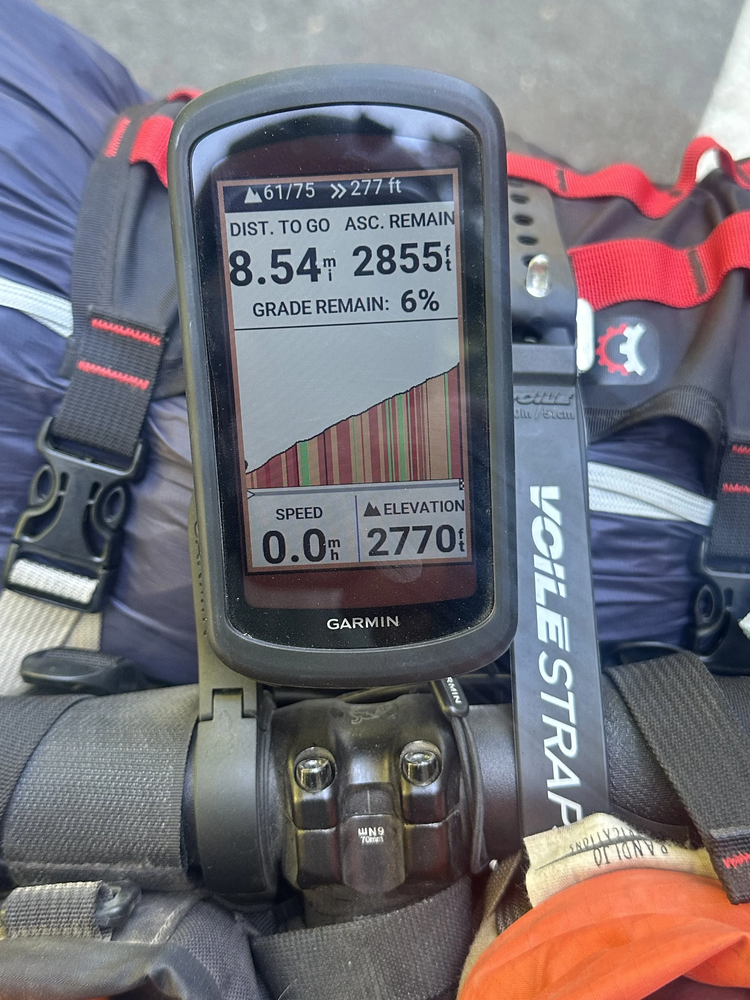
You'll climb for about 6 miles before you even hit this doozy.
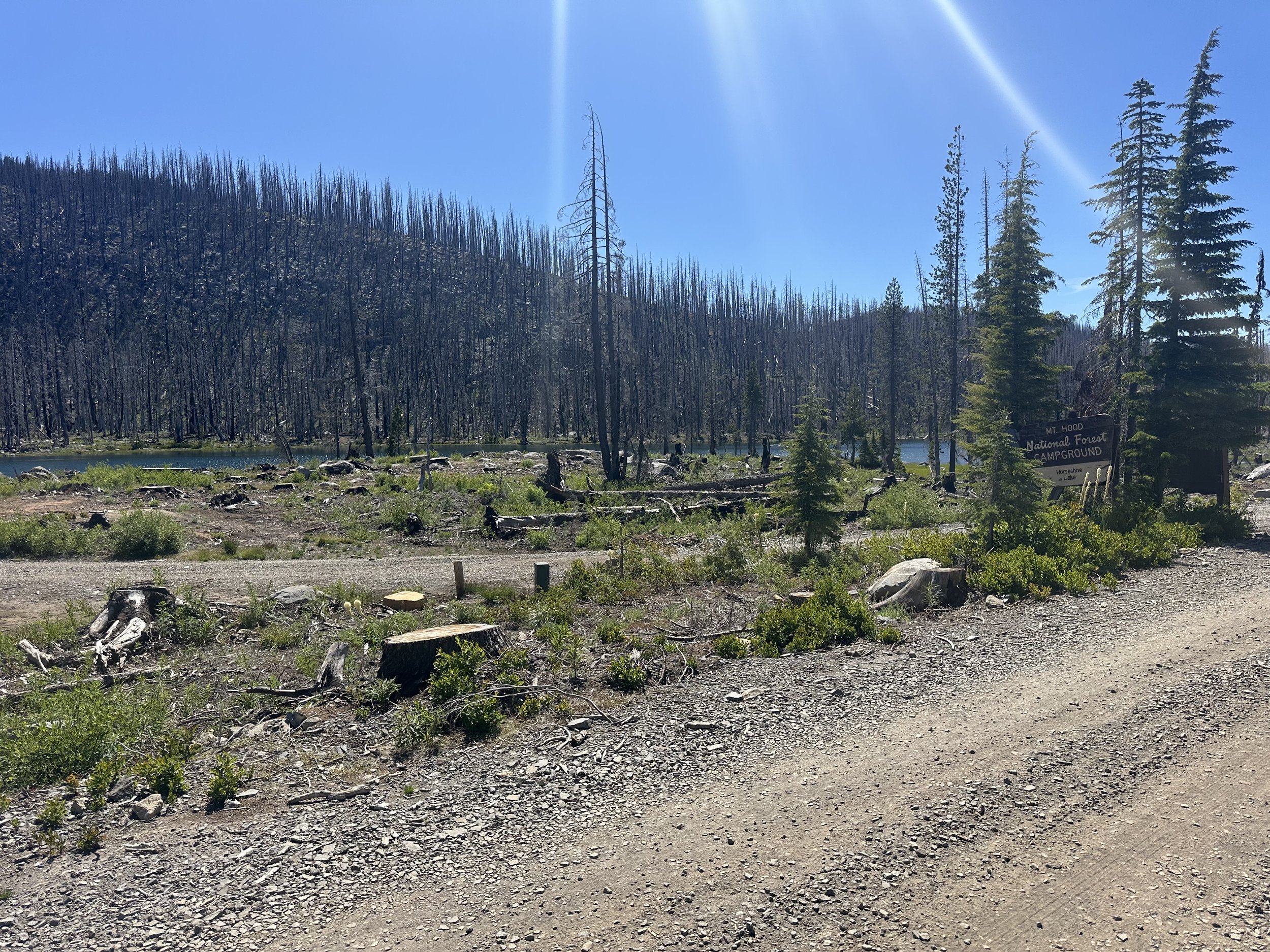
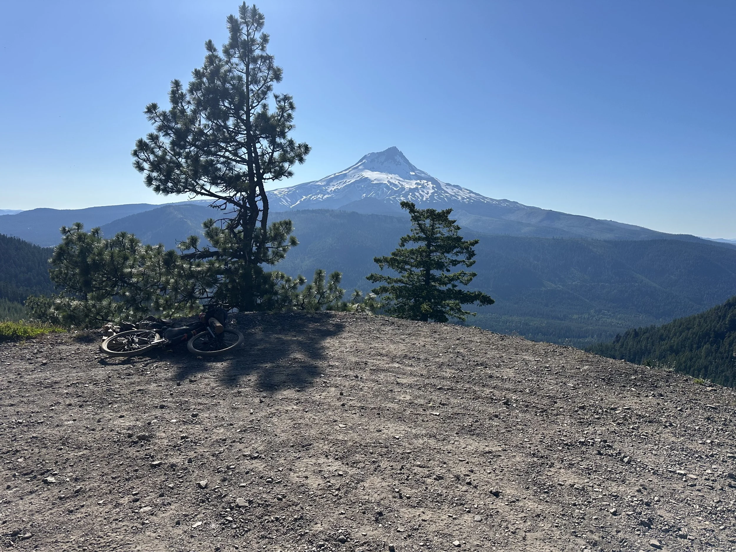
The first two miles or so of this climb are on pavement, then it turns into a very rough Jeep road—rice and beans with some beef stew mixed in—for another eight miles of hard riding. It's all rideable, but kind of brutal. The surface is loose gravel mixed with fist-sized angular rock making up much of the tread. This area burned hot, clearing all the trees and exposing the underlying landscape. When you stop or look up, you’ll be treated to amazing views of Mt. Jefferson, Olallie Butte, Rock Cone, and other Cascade geology.
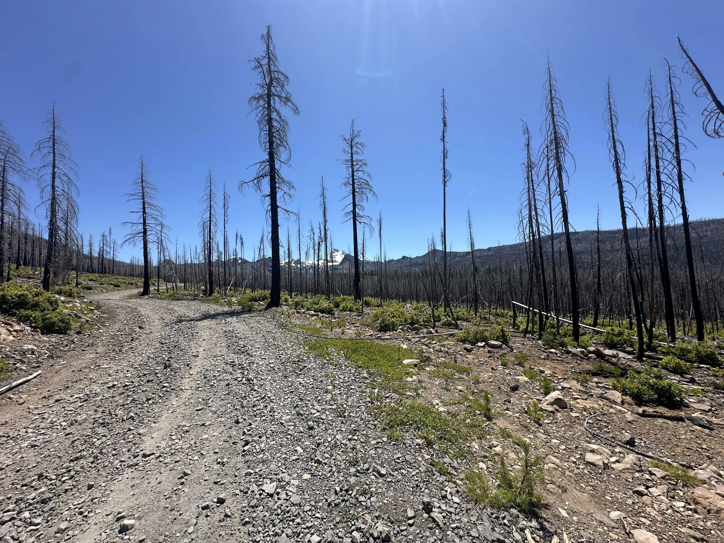
Not super steep, but long, hot, exposed and chunky

Pretty Amazing views the whole climb up. Look up, rather than down, it'll make the climb much easier

Uncooked rice and beans gravel. It wouldn't be so bad but its pretty loose and deep in spots
This hard, chunky eight-mile section took me more than two hours to climb and is followed by a slow four to five-mile downhill to Olallie Lake Resort. Technical and steep, there is lots of room for error with the potential for a broken bike or body. I gingerly made my way down to Olallie Lake, making slow and steady progress, hands tingling but still enjoying the downhill.

Top of the climb, no shade but a good spot for a break before the sketchy downhill to Olallie Lake
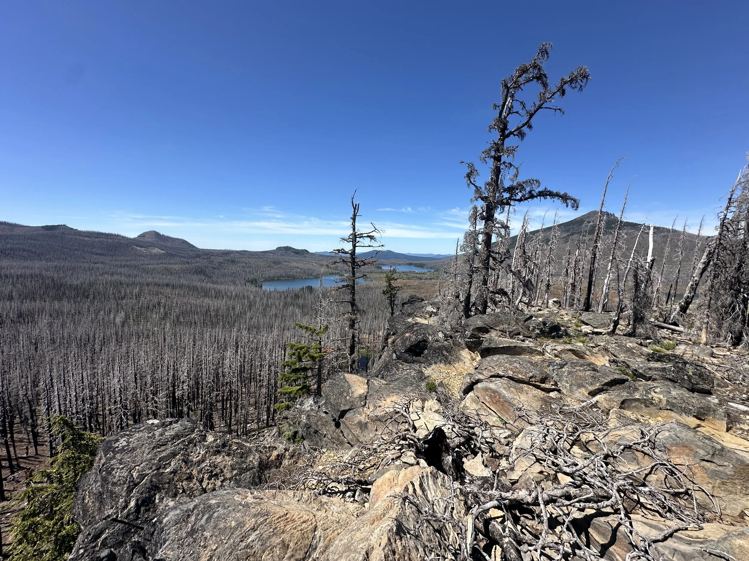
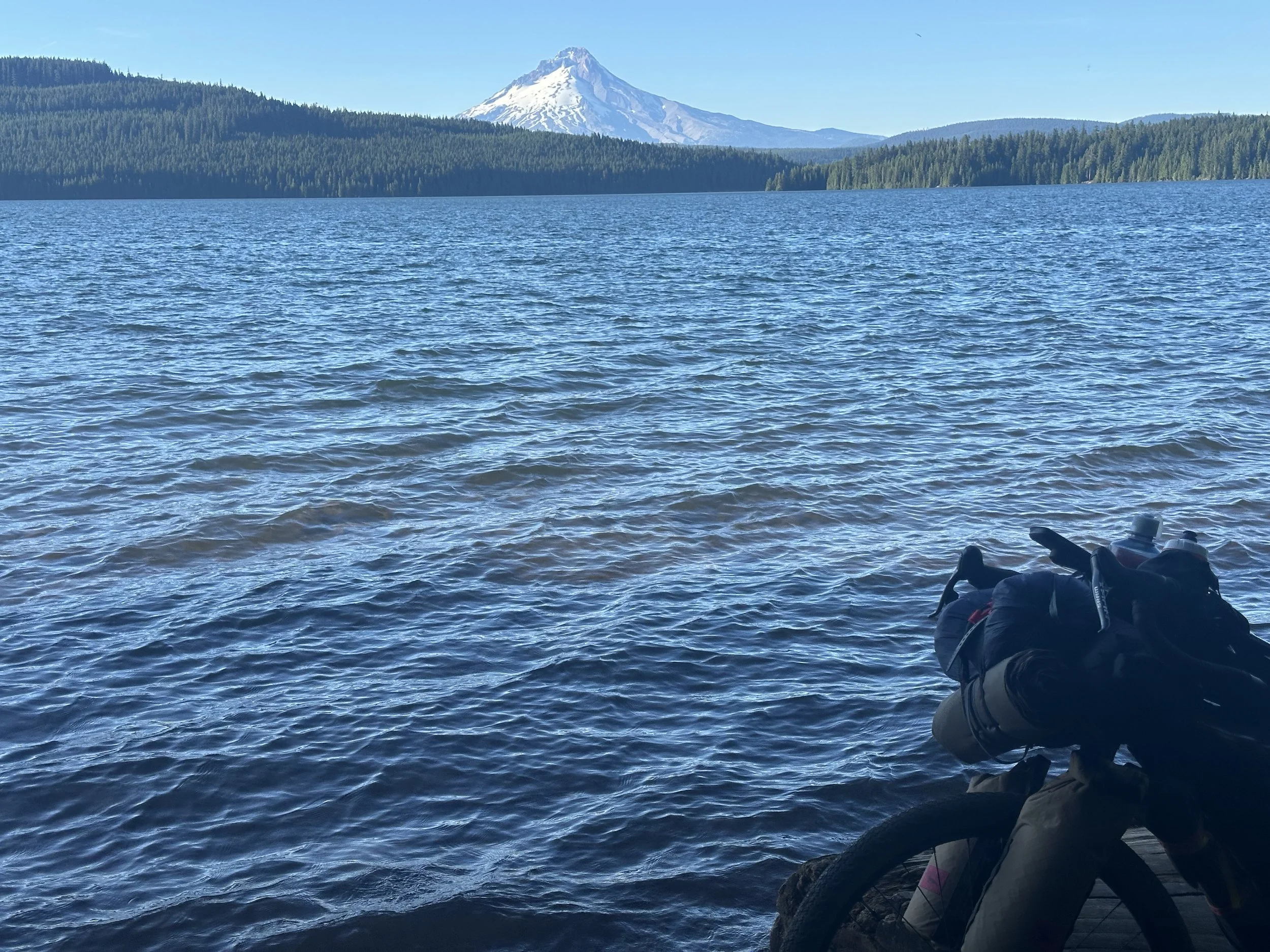
Monon and Olallie Lake. Lots to see from here
There are several campgrounds at the lakes along the road, but they’ve all been impacted by the fires and don’t offer much in the way of shade. Once off the descent, the road is still rough but much easier to navigate. Take your time and enjoy the views. Olallie Lake is a water supply lake, so swimming is not allowed. There are plenty of other swimming options along the way, however.

Slow down and enjoy the flat roads along the many lakes here. Take a swim before you get to Olallie Lake, there are plenty of options.
The best camping I saw was at the Paul Dennis Campground near the Olallie Lake Resort; it's one of the few fully functional campgrounds left in the area. The resort store has a lot more groceries than you might expect and serves as a decent resupply point. Best of all, they have a refrigerator full of beer. It was glorious. The store is cash-only!, so plan accordingly. You’ll be disappointed if you don't. There is also a drinking water spigot just off the store’s porch to top off your bottles.
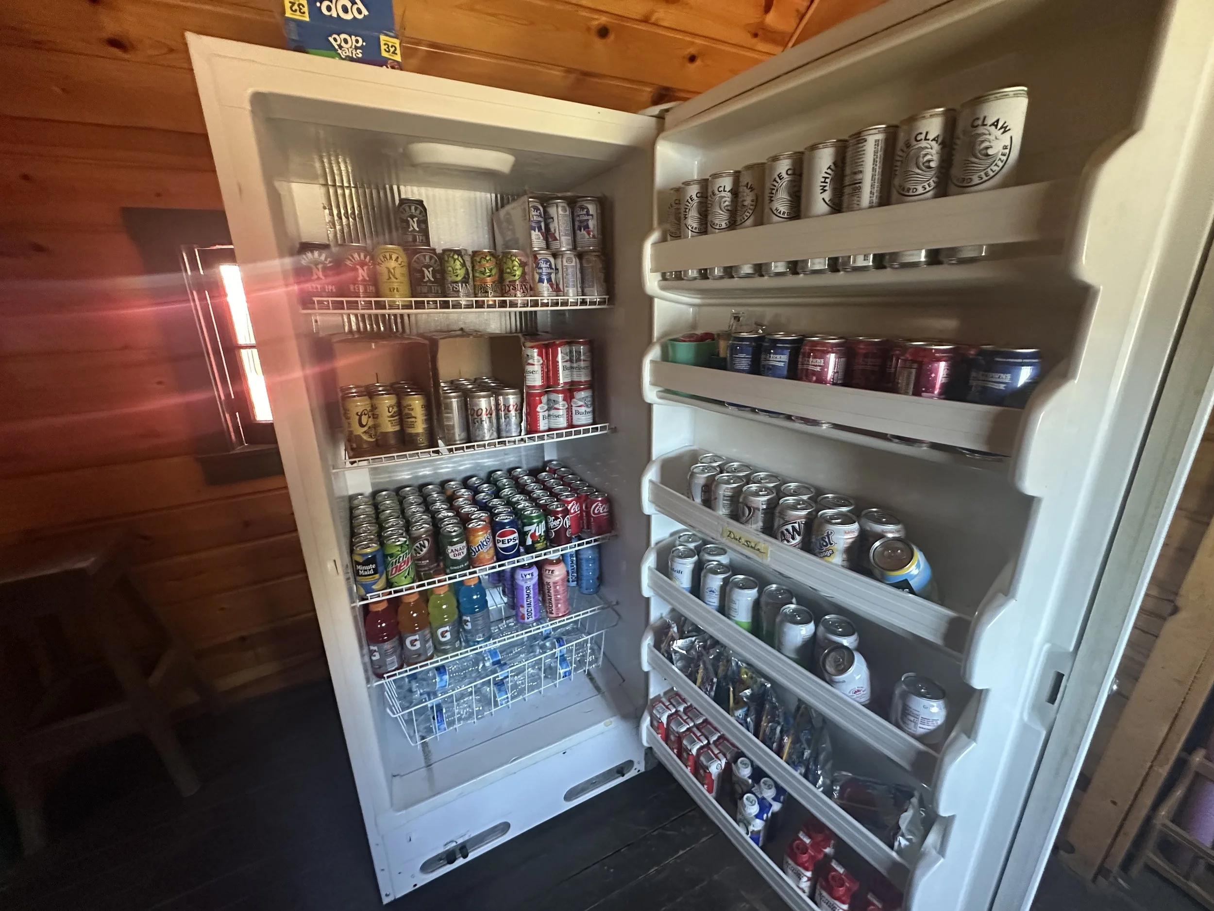
In case you didn't get the message, CASH ONLY! In retrospect, I should've camped here

I still had 30 miles to go, so limited myself to one PBR. I could've easily cleaned out their fridge.
After enjoying a cold Pabst Blue Ribbon and some snacks, I got back on the bike for the remaining 30 miles to Timothy Lake. The route is mostly downhill on good pavement and gravel, with only a short 1-mile climb before reaching the final 10-mile descent into Timothy Lake. After the punishing climb earlier in the day, it was nice to spin my legs on flat roads to the lake.
Once close to Timothy Lake, the route turns onto the Timothy Lake trail, a beginner-level mountain bike and multi-use trail that gets busy on the weekends. Really busy. I was fortunate to hit it on a Monday, but there were a lot of folks from the 4th of July weekend still camping. If you need water, fill up at the spigots at one of the three campgrounds. I followed the single track past the dam to the dispersed camping areas on the west side of the lake. I was exhausted by this point and ready for an easy night. After wading in the lake to give my feet a break, I set up camp, ate dinner, and went to bed, exhausted from the 4,700 feet of hard climbing and glad to be lying down.
The campgrounds get super crowded, so keep riding past the dam and you'll find more remote dispersed sites. Also, Timothy Lake is a great swimming, plan accordingly
Basic Necessities
Water:
Water was not hard to find in this section. You can top off when you cross the Breitenbush River after about 11 miles into the climb, then there are ample rewatering options down to Olallie Lake.
The easiest refill is the spigot at the Olallie Lake Resort. Top off here before you continue on. There are a lot of creeks to filter at, or if you have enough water to get to Timothy Lake, fill-up at one of the spigots in the campgrounds.
Camping options:
This whole area was heavily burned five years ago, and the campgrounds are just now opening. There are a lot of options, all pretty exposed. The Paul Dennis/Olallie Lake Campground is the best option.
Plenty of Campgrounds at the lakes dropping into Lake. The fires clear out a lot of the cover, and some of the campgrounds are closed. Paul Dennis CG at the Olallie Lake Resort is the best option
Plenty of Campgrounds at the lakes dropping into Lake. The fires clear out a lot of the cover, and some of the campgrounds are closed. Paul Dennis CG at the Olallie Lake Resort is the best option
If you push past Olallie Lake, Timothy Lake is the next best camping. It gets busy, but during the week you can find a spot, either in the campgrounds or keep riding around the lake and you’ll find walk-in spots after crossing the dam and past the day use area. There are also a lot of creeks along the way so if you’re looking for a dispersed camping spot, there are a lot of options.
I should have stuck with my original camping plan and stayed at Paul Davis CG instead of continuing on to Timothy Lake because the ride into Timothy Lake from Olallie Lake is pretty easy. Past Timothy Lake is also easy, before it gets really, really hard with a 16 mile climb to the top of Lookout Mountain. At the top, you’ll see the High Prairie trailhead and there’s also a Dog River cross near there. This is where I should have camped, since it’s the last easy watering option before Parkdale.
Resupply options:
The Olallie Lake resort has a surprising variety of food and you can top off before Parkdale. They are CASH ONLY, you’ll be disappointed if you didn’t bring any. And…they have a fridge full of beer, at a good price.
Route:
The climb from Breitenbush up to Breitenbush Lake is no joke. It is long, steep at times, loose, and rough. The first few miles are paved, then turning to gravel further degrading to uncooked rice and beans gravel. Don’t let it break your spirit, but it certainly has the potential to do so. I took shade breaks where I found them, took walking push breaks near the top to give my quads a rest, but also kept moving and snacked frequently. It's brutal and intermediate mountain bike skills and experience are a must, but the uphill is rideable, the downhill slow but fun, and the views are incredible.
The trail around Timothy Lake gets really busy on the weekends in the summer. If you hit it on a Saturday or Sunday, consider sticking with the road to avoid Timothy Lake Trail and its onslaught of hikers.
Day 10: Timothy Lake to Gibson Horse Camp
Link to Ride With GPS for this section: https://ridewithgps.com/routes/51635974
| Total Mileage | 52.4 |
|---|---|
| Elevation Gain / Loss | +5,778 / −5,049 |
| Max Grade | 9.7% |
| Total Duration | 9:35 |
| Moving Time | 7:35 |
| Stopped Time | 2:00 |
| Cumulative Mileage | 537.1 |
| Cumulative Elevation Gain / Loss | +39,589 / −40,076 |
Ride Report
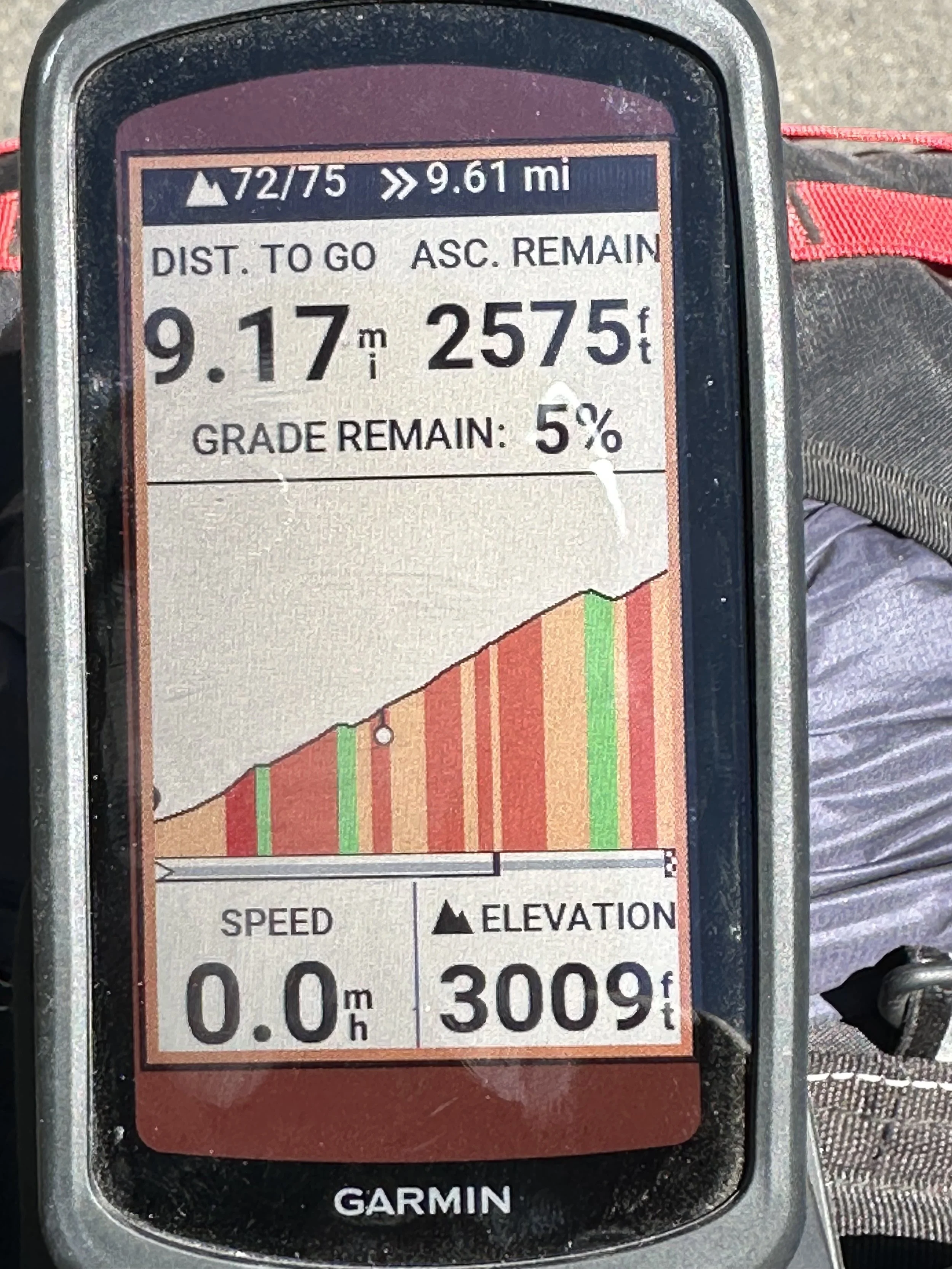
I started the morning with a swim in Timothy Lake before making breakfast and packing up. I was still a bit thrashed from the previous day, so I was moving slowly. Leaving camp on the beginner mountain bike trails, I soon hit the Pacific Crest Trail, where I had to walk my bike for a few hundred feet before remounting and continuing on the trail before it intersects with Road 58. After about five miles of pavement, the route turns off onto a gravel/dirt road and meanders its way up to Highway 26. From here, the route passes under Highway 26 through a wildlife tunnel. The road past Highway 26 is of decent quality and continues for 2.5 miles before the intersection with Cedar Burn Road. Although it's only about 15 miles into the day’s ride, this intersection is a good spot for a snack break and the best place to filter water. Make sure you are topped off on water here, sources get scarce the higher you climb. After this intersection, the route follows the paved road for a rolling five miles, then turns uphill for a 13-mile, 3,000-foot climb to the top of Lookout Mountain.
This climb starts after 20+ miles into the day. It makes up about half the day's climbing and is long, hot, loose, chunky, and pretty debilitating. Apply Rule 5 and you'll be fine
The first two miles of this climb are on hot pavement, then it turns to butter gravel that slowly deteriorates to rice and beans as the climb progresses. This climb is more rideable than yesterday’s climb to Breitenbush Lake, but it’s long, challenging climbing on loose angular rock and boulders. You’ll need to hold fast to Rule 5 to make it up this climb. Mt. Hood comes out in full force and offers some distraction from the pain and suffering of the climb. 13 miles of climbing took me 2.5 hours, and after a short 1.5-mile downhill, the route resumes with another two mile, 700-foot climb before the road finally turns downhill near High Prairie (about 36 miles into the day). I should have camped here, near Dog River at the top of the climb, but I didn’t and instead started the descent.
I found some shade near the top of the climb.
The downhill section is slow and technically challenging before connecting to the pavement of Road 44, but at least it's downhill. Although I planned on camping at the Knebal Springs Campground—where I’ve camped before and know there is a good pit toilet and water—it's quite a detour. After descending 1.5 miles, I decided to turn around and instead head to Gibson Horse Camp. I had about two liters of water left and hoped to cross a stream before getting to the camp, since there is no water at Gibson Horse Camp. You might be able to find water where Dog River crosses Road 44, but I wouldn’t count on it. Fill up at Dog River near the High Prairie Trailhead since that is the easiest water until Parkdale.
Fortunately, when I got to the Gibson Horse camp, there were two campers who generously topped off my water, so I enjoyed a dinner of hot ramen before going to bed, once again exhausted from the 52 miles and almost 6,000 feet of climbing.
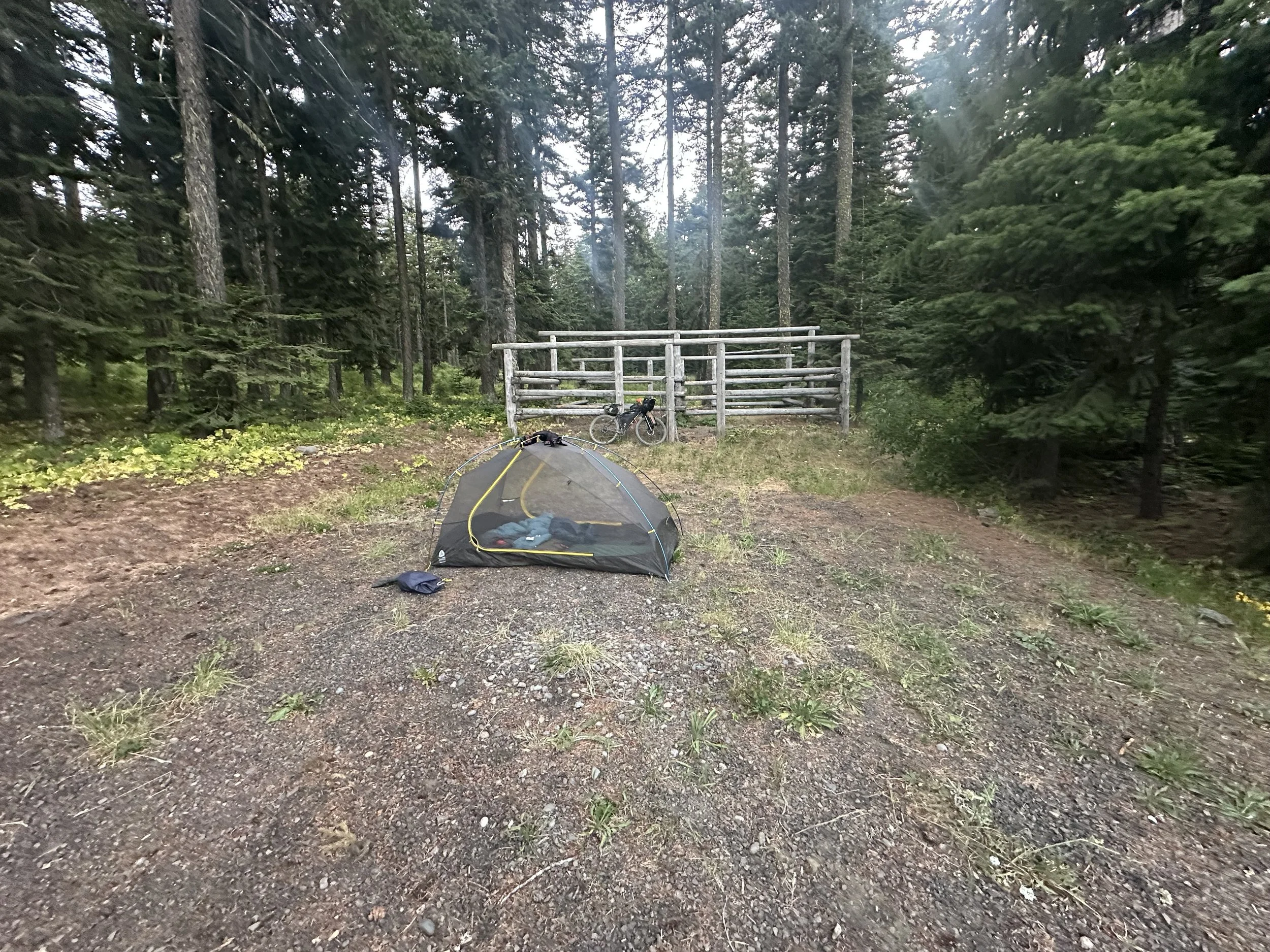
Gibson Horse Camp. Good enough to put up a tent, but not much else.
Basic Necessities
Water
Make sure you top off your water at Cedar Burn Road. This is also a great snack spot and the last shade for a while. Water gets scarcer the higher you climb and there will be few, if any, options without detouring off the route to find a stream crossing. If you find any water near the top of the climb, top off again—you might not find any water near where you camp.
Camping options:
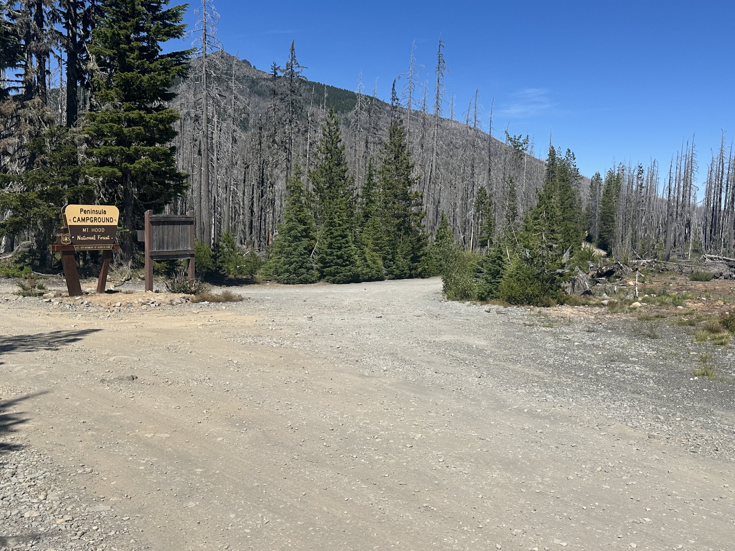
There aren’t good campground options on this section. I thought the Knebal Springs Horse Camp would be a good option, but it is a long detour off the route. I camped at Gibson Horse Camp, which was okay but only had a pit toilet, raggedy picnic tables, and no water.
As I mentioned in the previous post, I should have camped at the top of the climb at the High Prairie Trailhead where it crosses Dog River on Road 4420 (36 miles from my camp at Timothy Lake). It’s a few hundred yards from where the route crosses Road 4420 and it’s the last good water until Parkdale. And aside from a few short climbs it's all downhill into Parkdale. With an overnight rest, I would have enjoyed the next day’s downhill a lot more.
Resupply options
None
Route:
Like yesterday, this climb is no joke. It feels like it continues forever, and the tread is loose and rocky and will test your limits. Slow down, take breaks and be patient and you’ll get to the top. It’s a trudge but it’s all within reach.
This is a really great mountain bike area maintained by the 44 Trails Association. If you have the energy and wherewithal, consider descending some of the single track, or even hang out for a day or two to ride a few of the trails. They’re fantastic.
