
© Gabriel Amadeus
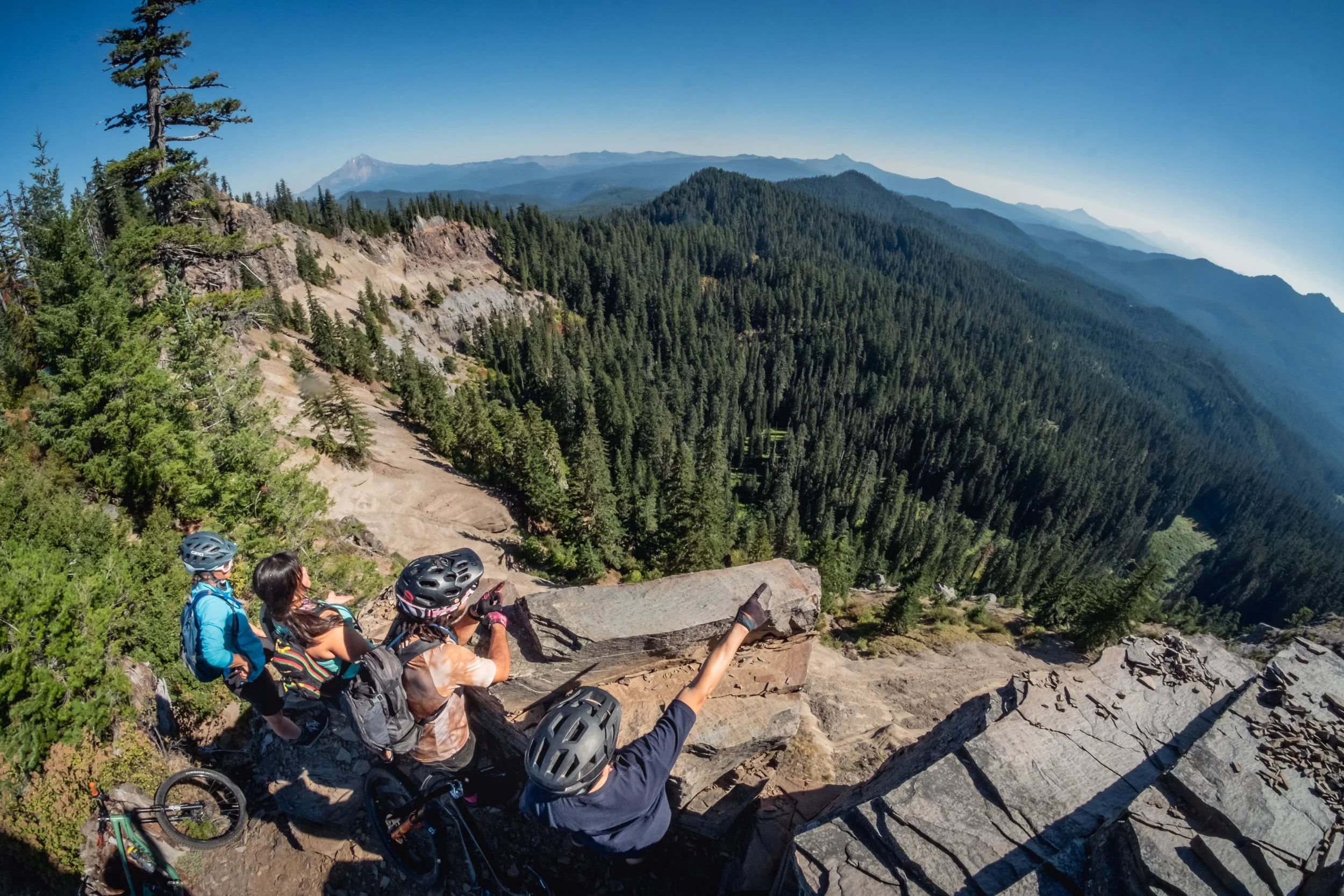
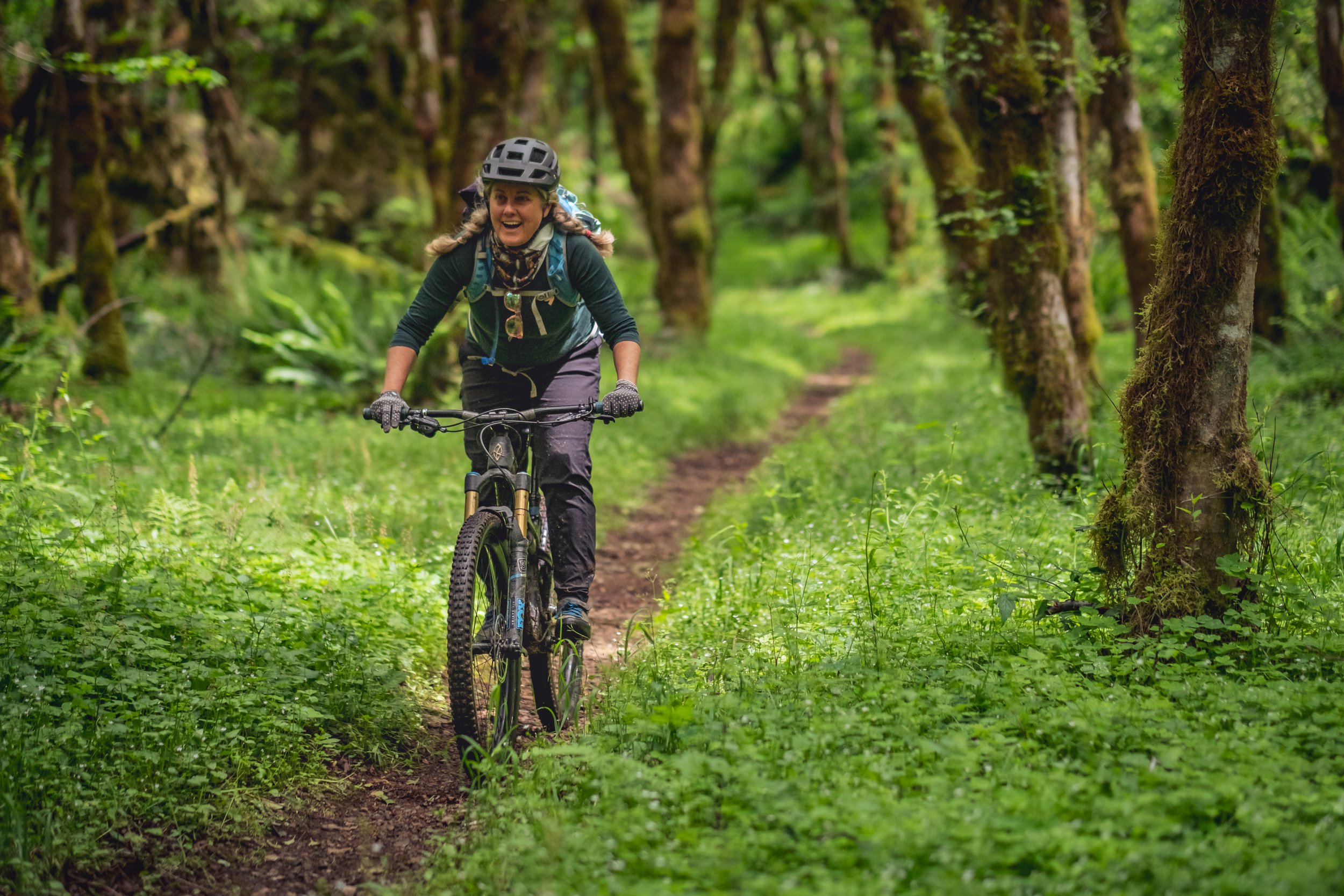
Traveling the Santiam Canyon is a bit like traveling back in time. As you head east from the Willamette Valley, you ascend into the Cascade Range foothills—where the Santiam Canyon begins to envelop the Santiam River and its tributaries in basalt-strewn, old-growth forests of Douglas fir and mountain hemlock. These heavily forested ridgelines and valleys are home to the Old Cascades—a remote region that’s home to some of the most cherished trails along the whole Oregon Timber Trail.
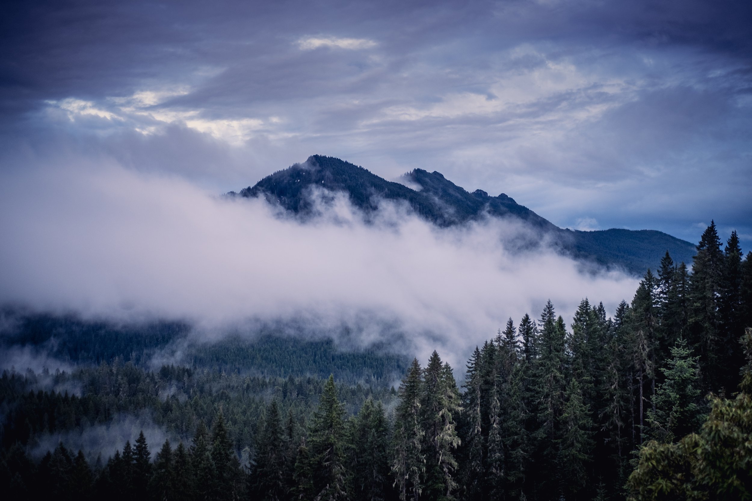
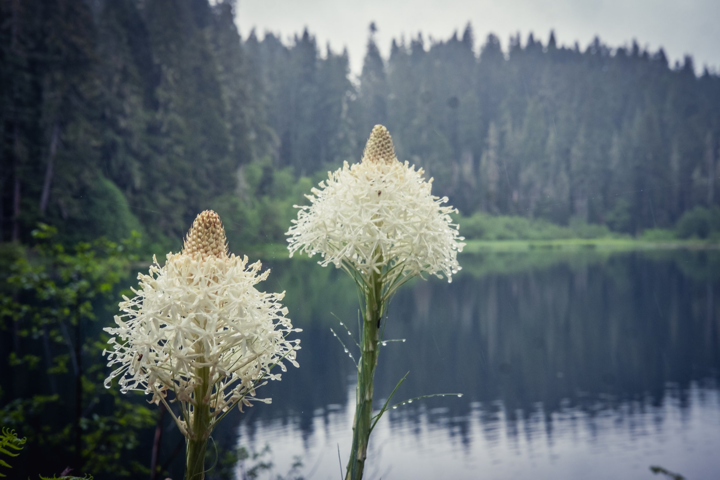
And as you rise into the Cascades, the ancestral home of the Santiam Molalla and Kalapuya, you begin skirting the Old Cascades—a mountain range that (as the name implies) predates the modern-day Cascade Range by many millions of years. Here in the Old Cascades, the peaks don’t rise quite as high—but nevertheless host ancient forests, meadows covered in summertime wildflowers, sweeping viewpoints, and other outdoor wonders. Best of all, this less-visited corner of the Cascades offers no shortage of solitude.
The region has also earned acclaim for hosting some of Oregon’s most scenic mountain bike trails.

© Gabriel Amadeus
Re-envisioning Recreation in the Santiam Canyon
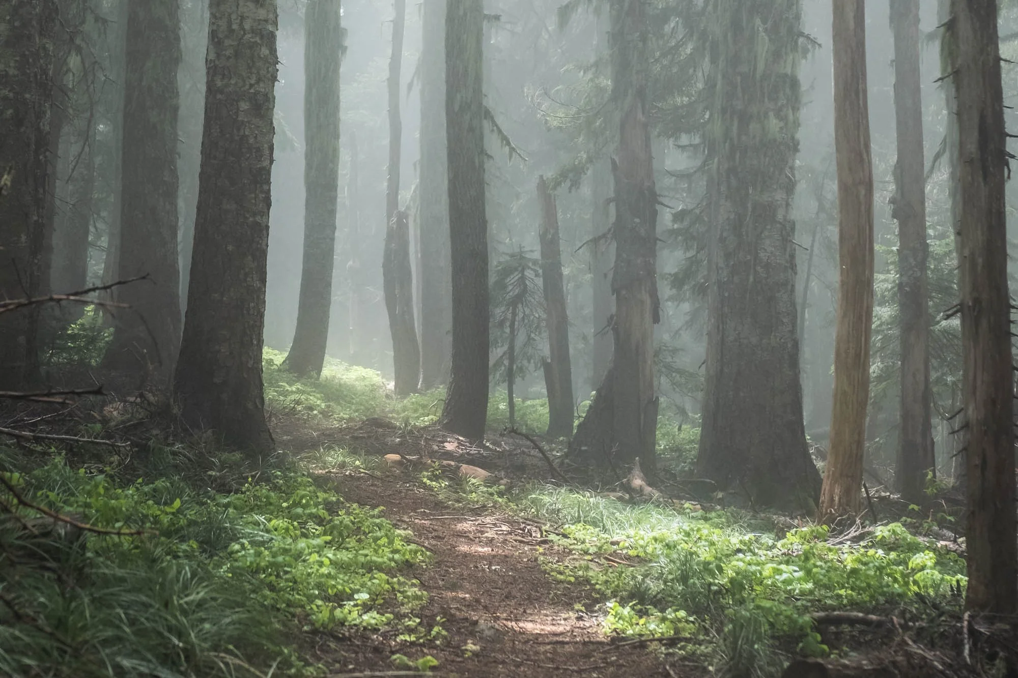
In recent years, trail builders have restored a network of trails built more than 100 years ago that traverse the Old Cascades—following ridgelines, descending steep slopes, and switchbacking past clearings that encompass views of Mount Jefferson, the Three Sisters, and other iconic peaks.
That work has been undertaken by volunteers and advocates within the organizations that make up the Resilient Headwaters Coalition, which in recent years has been envisioning new trails and restoring historic paths throughout the Santiam Canyon region and across the wider Santiam watershed. This exciting vision would not be possible without the contributions from the many people who love this place as much as we do—learn more about this vision and who’s involved.
Wildfires in the area burned more than 700,000 acres in 2020, and Resilient Headwaters hopes to help with recovery while expanding the footprint of mountain biking and other recreation in the Santiam Canyon, drawing new visitors to the region, and supporting these rebuilding communities—where tourism and outdoor recreation is often the backbone of local economies.
As that work continues, and as volunteers rehabilitate fire-damaged and neglected trails, the Resilient Headwaters Coalition is planning and designing more beginner-friendly paths to meet the growing popularity of outdoor recreation. In the meantime, we’re excited to showcase these 10 mountain bike adventures throughout the Santiam River watershed and the Old Cascades Crest. These under-the-radar outings feature a mix of intermediate and more advanced routes, with plenty of challenges for casual riders and veterans alike. So as you look for your new favorite mountain bike destination, keep reading for a breakdown of 10 epic rides in the Santiam Canyon.

© Gabriel Amadeus
Tips for Mountain Biking in the Santiam Canyon and the Old Cascade Crest
Before planning your trip into the Santiam Canyon and Old Cascades, you’ll want to keep a few tips in mind for the best possible experience.
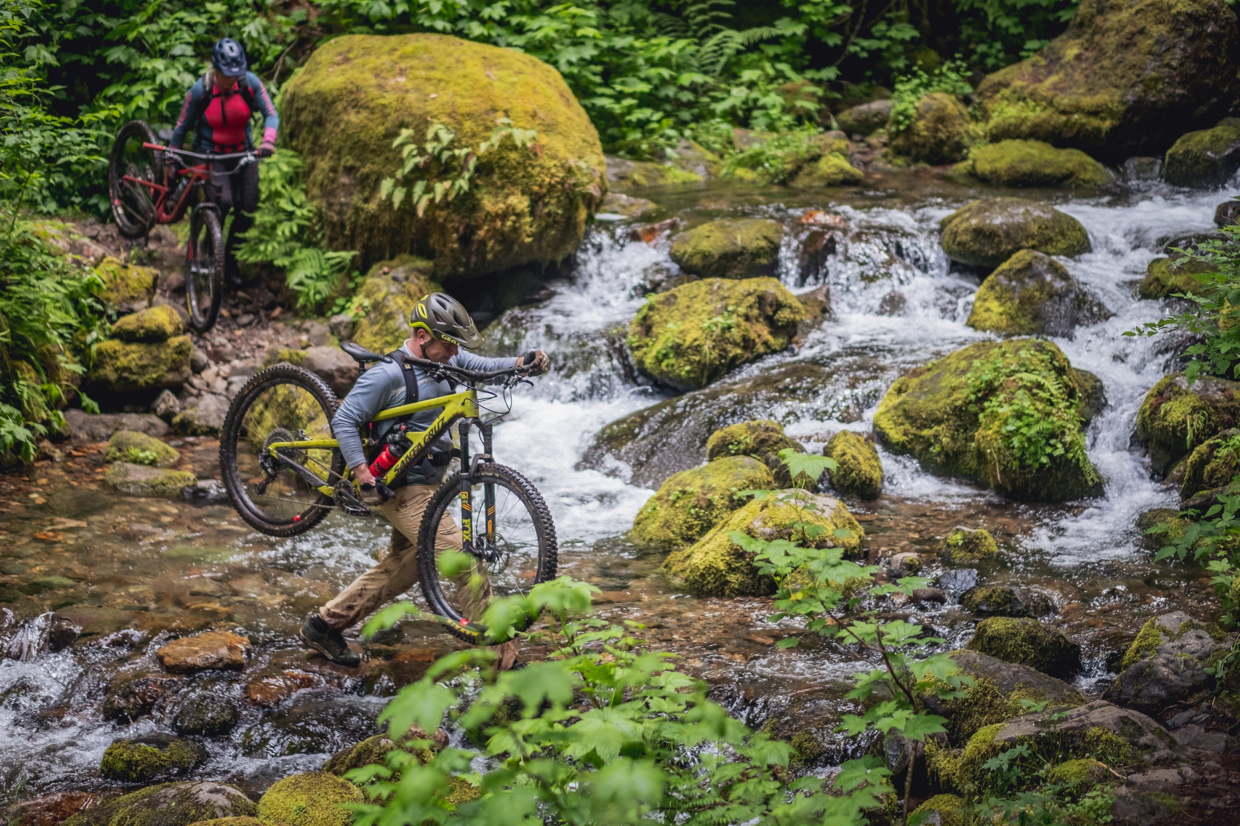
Best seasons for riding: Routes across the Santiam Canyon and Old Cascades are generally accessible between early July and October; the rest of the year, the region is blanketed under snow. Early in the season, riders may encounter downed logs along trails and frequent mosquitos. And as the weather warms up in summer, frequent springs, swimming holes, and thick forests make the Old Cascades Crest a quiet destination to escape the heat.
Water: When planning a ride around the Santiam Canyon, bring more water than you think you’ll need. Water sources (all of which require filtration) can be infrequent and unreliable in the Old Cascades, depending on the trail, so fill your CamelBak pack and pack along an extra jug or two before setting out.
Services: Riders should be self-sufficient before considering a ride in the Old Cascades. Cell service is unreliable, and services are non-existent. Bring all the tools you may need for bike repairs, a first-aid kit, and a well-fitting helmet.
Closest communities: Riders will encounter few services or offerings in the region around the Old Cascades; the nearest communities to the rides outlined in this piece are Detroit and Idanha, both of which are still recovering from 2020 wildfires that ripped through the area. Limited lodging, restaurants, and groceries are available—but in-town rentals are not, and you’re unlikely to find gear for sale in these communities. After your ride, grab a bite to eat or kick back with a pint to help support these rebuilding towns.
Farther south, the Middle and South Forks of the Santiam River flow towards the community of Sweet Home on Highway 20—this may be your best jumping off point to access Crescent Mountain and the historic Santiam Wagon Road.
Nearby campgrounds: While Detroit may have some lodgings available, summertime camping may be your best bet for overnight outings. Nearby (developed) campgrounds include Riverside at Detroit Campground (a remote outpost with drinking water and vault toilets) and Detroit Lake State Recreation Area (with nearly 275 tent and RV sites, showers, flush toilets, and other amenities near the shore of Detroit Lake).
Signage: Rides in the Old Cascades feature minimal signage, so download the Old Cascades Crest Ride with GPS routes to your phone before heading out, and acquire a U.S. Forest Service map of the area before hitting the trail.
Be nice, say hi: Whether you’re on a mountain bike, on horseback, or on your own two feet, we’re all sharing the trail with each other and with a multitude of flora and fauna that call these mountains home. Practice Leave No Trace principles, and be friendly to anyone you meet on the trail. Mountain bikers should always stop and yield to other trail users; it’s best to stop, dismount on the downhill side of the trail, and say hi—this indicates to oncoming hikers or horses that it’s safe to pass.
All the trails we feature in this article are designated multi-use non-motorized trails—which means ebikes and pedal assist mountain bikes are not allowed.
Hire a guide: Looking for a little assistance navigating this backcountry area? Want to get a van shuttle for the road sections? Two tour guide companies offer their services in the Old Cascade Crest area—Trans Cascadia Excursions and Horse Creek Lodge. Give them a call and see what kind of trip they can help facilitate for you and your friends.

Our Favorite Rides in the Santiam Canyon and Old Cascade Crest
Ready to hit the trail? Here’s a guide to ten of our favorite rides in the Santiam Canyon—along with mileage, difficulty, and other good-to-know tidbits for making the most of your adventure.
See all ten rides on our Ride with GPS Ambassador Page.
You can also get trail status reports, maps and directions via Trailforks.
This article was produced with support from the Willamette Valley Visitors Association and Travel Salem. It was written by Matt Wastradowski and photographed by Gabriel Amadeus.
#1: Scar Mountain Traverse

© Gabriel Amadeus
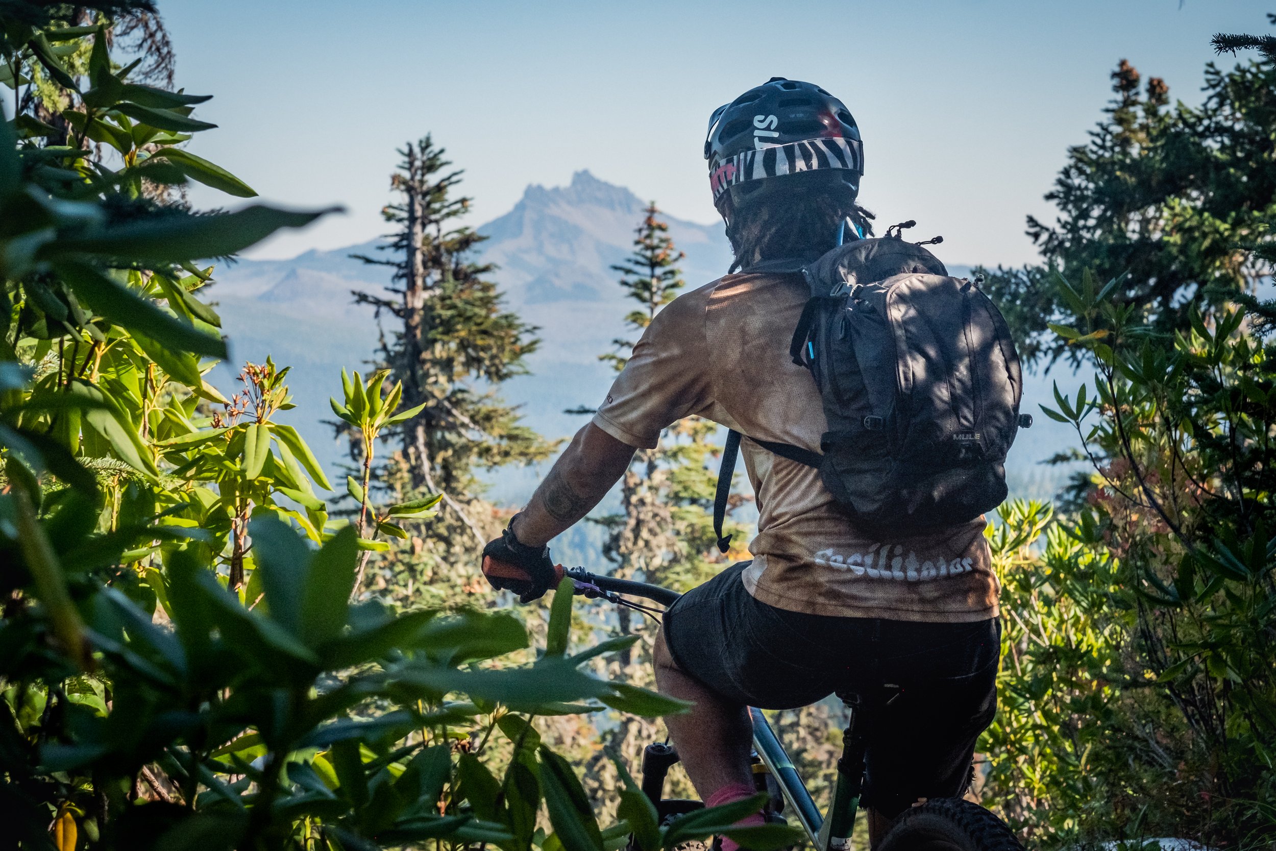
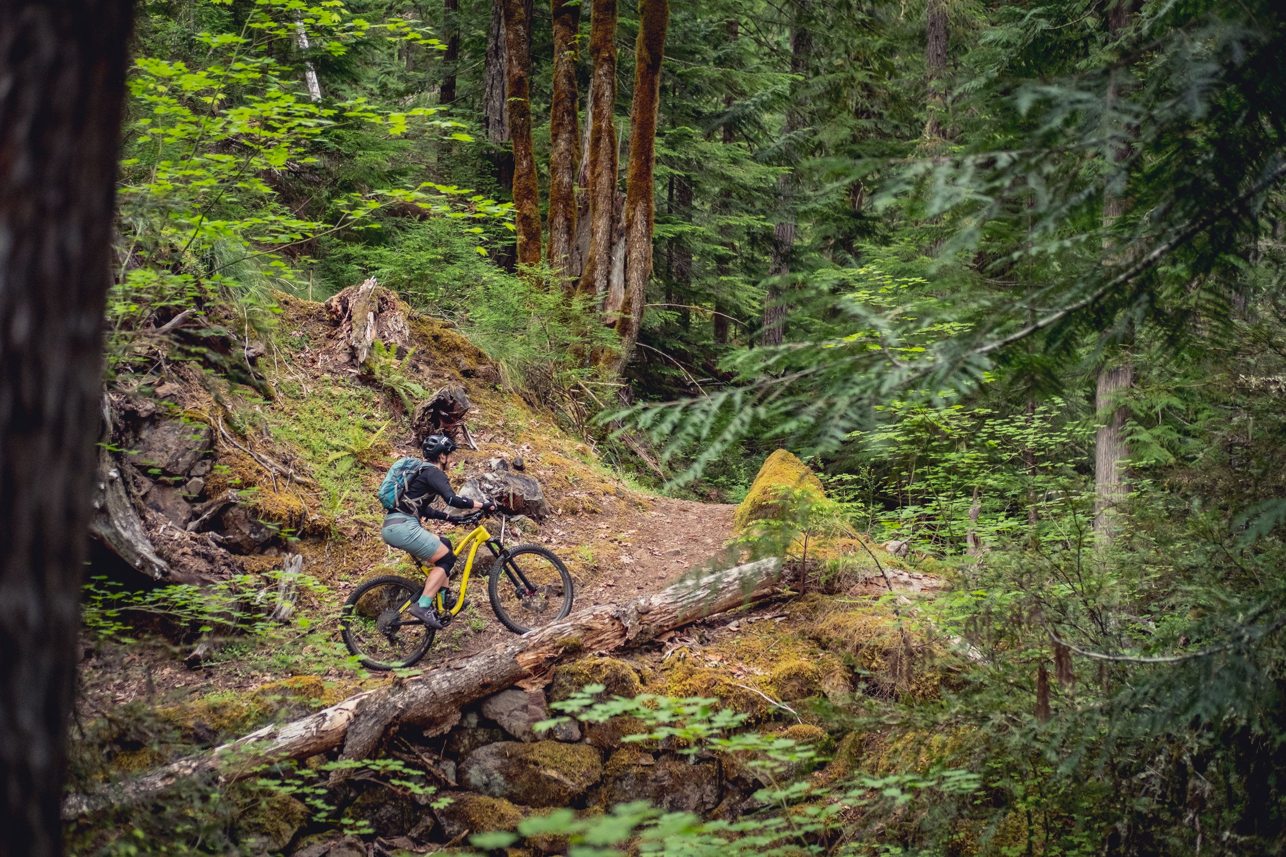
The Scar Mountain Traverse is the easiest of the rides we’ve outlined here—but riders will still encounter narrow trails, tight switchbacks, and steep sections along the way. Those who make the ridgeline ride, though, will be rewarded with views that (on a clear day) include Mount Hood, Mount Jefferson (especially striking from along Forest Road 1161), the Three Sisters, and other Cascade peaks. You’ll also crest Scar Mountain, one of the premier peaks of the Old Cascades.
In all, the traverse—which passes through forests of old-growth hemlock and Douglas fir—measures 6.2 miles round-trip and boasts about 1,200 feet of elevation gain. (It can be done as a three-mile, one-way trek if shuttled.)
Scar Mountain Traverse Stats
Distance: 6.2 miles
Elevation gain: 1,200 feet
Ride time: Two hours
Difficulty: Moderate
#2: Trappers Butte

© Gabriel Amadeus
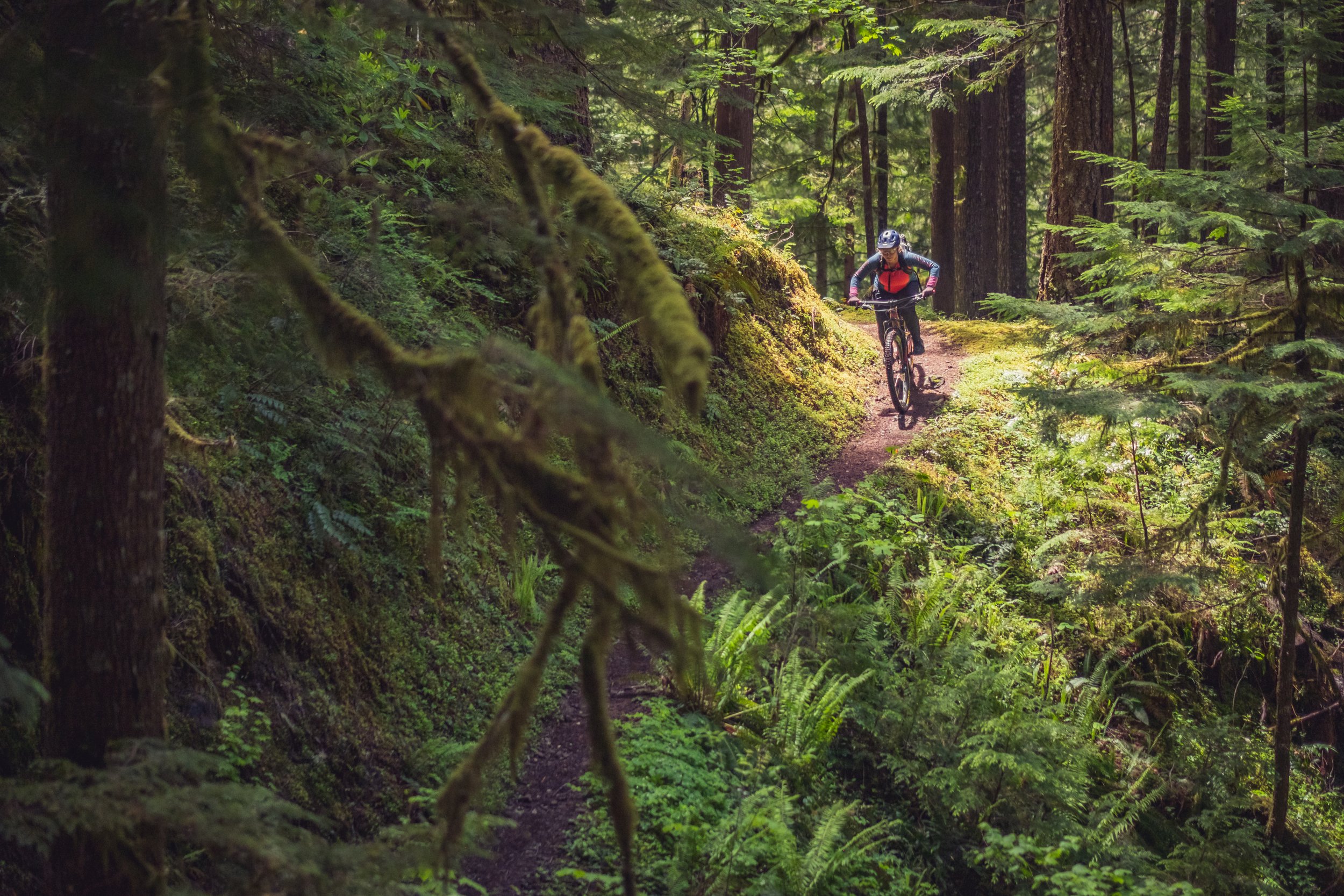
Trappers Butte offers a little of everything for riders of all skill levels. New and intermediate riders appreciate the ride’s gradual road climb and fast, flowy descent—while more advanced riders enjoy some of the ride’s tight switchbacks.
The entire Trappers Butte loop measures about 10.4 miles round-trip and boasts 1,600 feet of elevation gain—mostly via gradual climbs throughout the ride’s first seven miles. Once you start descending, you’re in for a thrilling ride through rhododendron (boasting blossoms of white, pink, and purple in late spring and early summer), mountain hemlock, and (as you near the trailhead) old-growth Douglas fir.
Trappers Butte Stats
Distance: 10.4 miles
Elevation gain: 1,600 feet
Ride time: Three hours
Difficulty: Moderate
#3: Scar Mountain and Trappers Butte

© Gabriel Amadeus
Can’t decide between Scar Mountain and Trappers Butte? With this ride, you don’t have to. The 16.4-mile ride combines Scar Mountain and Trappers Butte, boasting a 10-mile climb whose gradual elevation gain makes it far more approachable than the distance might indicate. (Of course, shuttling options are available.)
Following that climb, riders enjoy a roller coaster ridgeline ride (down and up) with wide-open Cascade views at the ride’s summit and a blistering descent down Trappers Butte. This loop is recommended for intermediate riders, owing to the exposed trails and occasionally tight switchbacks. Note that water is at a premium along this ride, so pack more than you think you’ll need.
Scar Mountain and Trappers Butte Stats
Distance: 16.4 miles
Elevation gain: 2,990 feet
Ride time: Four hours
Difficulty: Moderate
#4: Crescent Mountain Short Loop
© Gabriel Amadeus
The 14.5.-mile route along Crescent Mountain’s ridgelines isn’t for the faint of heart—it gains more than 2,600 feet—but rewards riders with up-close looks at the unique topography of the Old Cascades.
Appropriately enough, Crescent Mountain is named for its crescent shape; the alluring mountain forms an east-facing bowl with a trail that descends its north and south ridgelines. This route, noted for plenty of singletrack, starts with a mellow, seven-mile road climb before transitioning to a three-mile hike-a-bike to the summit; it’s a fine introduction to the area’s open meadows (where white, bulbous beargrass flowers in late spring and early summer), but more advanced riders may prefer the longer Crescent Loop Ride—which we’ll cover next.
Crescent Mountain Short Ride Stats
Distance: 14.5 miles
Elevation gain: 2,638 feet
Ride time: Four hours
Difficulty: Moderate
#5: Crescent Mountain Loop
© Gabriel Amadeus
Ready to really test yourself on Crescent Mountain? The Crescent Mountain loop traverses 18.4 miles while climbing nearly 3,000 feet, challenging even the heartiest of riders. But the rewards are some of the most gratifying views anywhere in Oregon.
In all, the ride comprises a gentle, nine-mile road and trail climb before hopping onto the North Crescent Trail, where the elevation gain hastens while ascending through ancient forests of fir and hemlock. Once at the summit, though, riders enjoy a fast, twisty descent that heads through scenic forests of Douglas fir and wide-open meadows (where wildflowers bloom between late June and early August). Keep an eye out for dead trees in those meadows; they have been intentionally girdled as part of a meadow restoration project to create snags for wildlife and to kill encroaching conifers to restore the meadow to a more natural condition.
One final tip: This is one of the more popular hikes in the area, so watch for pedestrians at all times—and especially on sunny summer weekends.
Crescent Mountain Loop Ride Stats
Distance: 18.4 miles
Elevation gain: 2,909 feet
Ride time: Five hours
Difficulty: Difficult
#6: South Pyramid Creek Ride
© Gabriel Amadeus
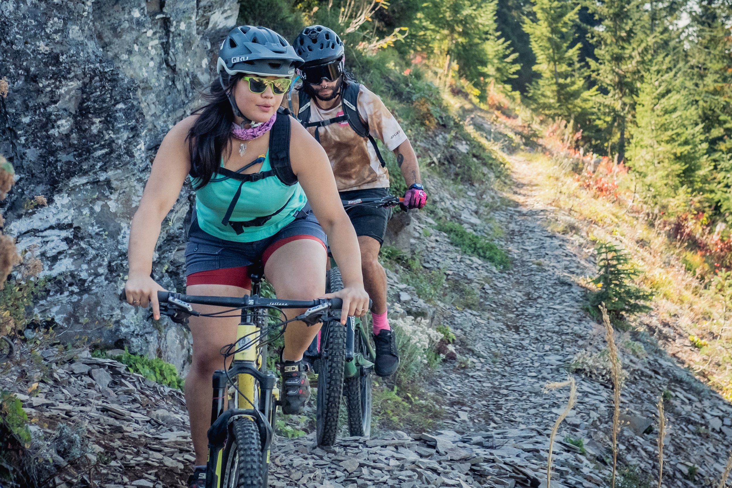
Ask any seasoned rider for their favorite outing in the Old Cascade Crest, and chances are good they’ll wax poetically about the South Pyramid Creek Ride. And it’s easy to see why: The 14.5 mile ride, comprising two loops and one out-and-back section, snakes through the Pyramid Creek canyon while showcasing dramatic views of some of Oregon’s oldest forests. Along the way, take a dip in the swimming hole near the Shedd Camp Shelter along the Middle Santiam River.
Given the different navigation options for completing this ride, it can be tough to know where to begin. (However you complete the ride, download the Ride with GPS route to your phone for an easier ride.) To stack most of the climbing at the start of the ride, park at the more remote South Pyramid Horse Camp trailhead (note that Google Maps directions are incorrect—consult with a map from the Sweet Home Ranger District for accurate directions) to begin an eight-mile road climb. From there, you’ll coast back down toward the Middle Santiam River, where a turn to Shedd Camp Shelter awaits; toward the end of the ride, you’ll face one final climb in which you’ll retrace your tracks up about 600 feet over 1.5 miles.
South Pyramid Creek Ride Stats
Distance: 14.5 miles
Elevation gain: 2,548 feet
Ride time: Five hours
Difficulty: Difficult
#7: The Three Pyramids Ride

© Gabriel Amadeus
So far, our rides have skirted around the Old Cascades Crest—but the Three Pyramids Ride heads into the heart of the region for a challenging ride that thrills with speedy descents and offers an opportunity for a mid-ride dip in the Middle Santiam River.
The ride ascends and skirts the edges of three basalt rock formations—the trail’s namesakes—while heading through towering old-growth forests and delivering views of a half-dozen or so Cascade peaks. Add an optional out-and-back to the Middle Santiam River (four additional miles round-trip) for a swim if you need a break and the weather cooperates.
Right out of the gate the demanding North Pyramid Trail is steep on the way up and the South Pyramid Trail is steep and chunky on the way down, while the second half of the descent along South Pyramid Creek trail is smooth and flowy—losing about 3,000 feet over the course of about six miles.
Three Pyramids Ride Stats
Distance: 15.7 miles
Elevation gain: 3,442 feet
Ride time: 5 hours
Difficulty: Difficult
#8: The Pyramids Epic Loop

© Gabriel Amadeus
Pack portable lights for this all-day ride. The 27-mile Pyramids Epic Loop incorporates elements of several other rides in this article while heading further into the Cascades and circling the entire Middle Santiam River drainage. Peak views, towering forests, and snaking singletrack are all hallmarks of this thigh-burning ride.
You can start at any of the trailheads along the route, but we’re partial to beginning from the North Pyramid Trailhead, riding clockwise, and finishing by descending down Trappers Butte. The ride itself is difficult, with a 3,200-foot climb to Scar Mountain in the midst of it all, and can take seven hours or more to complete.
Note that options for shortening the ride are limited; if you’re not feeling the entire 27-mile loop, you can start heading back at Forest Road 2047. And water is scarce along the second half of the remote, rugged ride; filter and fill your water at the Pyramid Creek crossing on the Chimney Peak trail, which provides the only reliable water source before the grueling Scar Mountain climb.
This ride passes near the Middle Santiam Wilderness—mountain bikes and other mechanized equipment are not allowed in designated Wilderness Areas so make sure you follow the right trail when beginning the Scar Mountain climb.
Pyramids Epic Loop Ride Stats
Distance: 26.9 miles
Elevation gain: 6,477 feet
Ride time: 6-7 hours
Difficulty: Difficult
#9: The Pyramids Popsicle

© Gabriel Amadeus
There’s no getting around it: The Pyramids Popsicle Loop is, far and away, the most difficult ride on this list. This particular loop takes the aforementioned Pyramids Epic Loop (which itself comprises numerous rides we’ve listed in this piece) and adds an out-and-back trek over Crescent Mountain.
Add it all up, and you have 42.6 miles of climbs and descents through some of Oregon’s oldest landscapes in the heart of the Cascades—complete with more than 10,000 feet of elevation gain. Bring plenty of water, pack portable lights, and start early for this less-traveled trek through a variety of terrain.
This ride passes near the Middle Santiam Wilderness—mountain bikes and other mechanized equipment are not allowed in designated Wilderness Areas so make sure you follow the right trail when beginning the Scar Mountain climb.
Pyramids Popsicle Ride Stats
Distance: 42.6 miles
Elevation gain: 10,363 feet
Ride time: 9+ hours
Difficulty: Very Difficult
#10: Old Santiam Wagon Road
© Gabriel Amadeus
Finally: some relief! We’re taking a break from increasingly more difficult rides to shout out the much easier Old Santiam Wagon Road, a jaunt at the southernmost regions of the Old Cascades Crest region.
As the trail’s name implies, you’ll follow the remnants of an old wagon road that European-American emigrants once used for taking livestock to markets in Central Oregon and beyond. The 10.3-mile (one-way) is one long descent (over 3,000 feet) through various types of forests. Wayfinding can be tricky, especially since most of the trail’s road crossings are poorly signed, so download the Ride with GPS route to your phone for navigation assistance when necessary. Having a second vehicle positioned at both trailheads along this path is highly recommended; otherwise, the out-and-back tops 20 miles and can be quite difficult.
For even more adventure, the Santiam Wagon Road continues towards the crystal blue headwaters of the McKenzie River at Clear Lake, and eventually over Santiam Pass towards Sisters.
Old Santiam Wagon Road Stats
Distance: 10.3 miles (one-way, not a loop)
Elevation gain: 363 feet
Ride time: 2-3 hours
Difficulty: Easy
Excited to learn more? Check out other mountain bike rides in the Willamette Valley and Cascade Range.
This article was produced with support from the Willamette Valley Visitors Association and Travel Salem. It was written by Matt Wastradowski and photographed by Gabriel Amadeus.
© Gabriel Amadeus