

Deschutes River Trail enveloped in mist. Photo: Chip Andrus
Staying fit for Bikepacking
from the Winter Solstice to the Spring Equinox
by Chip Andrus
Those who live in soggier parts of the state know that winter riding is challenging due to rain and still more rain. Fitness and general well-being gradually go downhill. Exiting winter stuck in these doldrums is a poor run-up to the summer bikepacking season.
Fortunately, northern Oregon can serve up some excellent winter riding just east of the Cascade Mountains. Rainfall in The Dalles is half that of Portland and the sun shines quite a bit in the winter. Some snow may linger at the higher elevations in mid-winter but it's transitory. Just pick your days well.k
Drive east through the Columbia River Gorge and here is what you can find for winter solstice to spring equinox riding that doesn't leave your feet wet. And while you're out there why not try a winter overnight trip along the Deschutes River. You'll must likely have it to yourself.
Deschutes River Trail. Photo: Daniel Sharp
Lower Deschutes – Out and Back
Length: 38 miles out and back

Deschutes River Trail. Photo: Chip Andrus
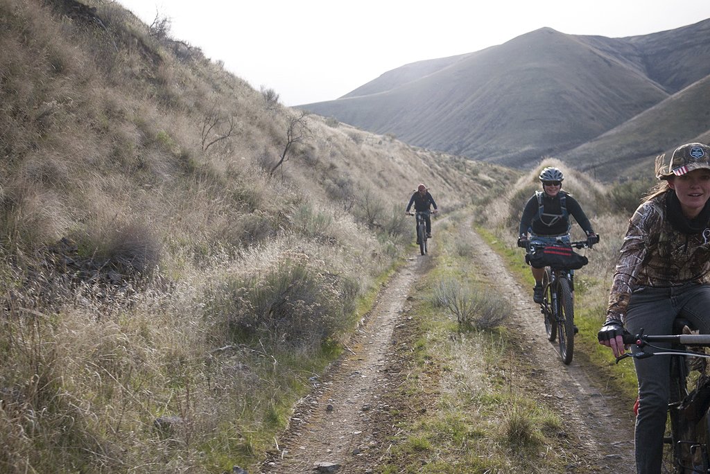
The Deschutes River trail is a route that winds along the east bank of the river. It's an old railroad grade that starts as smooth gravel and gets progressively rougher until the end at mile 19. Like most rails-trails, the gradient is barely noticeable. You can make this trip any length you want since it is an out and back route.
Sagebrush and grasslands are the theme, along with a sliver of trees along the river margins. The construction of the railroad grade in 1909 required blasting through some massive basalt cliffs. In other places, the terrain is gentler and they made more progress.
Cycling through this country in the winter is quiet (except for an occasional train on the railroad line on the other side of the river) and it may be just you and the bighorn sheep moving about. You can spend the night at any of the seven very rustic campsites along the way. A few have outhouses.
End of the line, unless you like to hike your bike. Photo: Daniel Sharp
Middle Deschutes – Out and Back
Length: 66 miles out and back

Climbing: 2100 feet
Maximum elevation: 1000 feet
Surface: 88% unpaved road, 12% paved road
The Middle Deschutes route is simply a continuation of the Lower Deschutes trail except that a four mile section of undeveloped railroad grade separates the two. Some have hiked and carried their bikes through that four miles in order to connect them but it's hard work. Instead, the Middle Deschutes route can be accessed at the town of Maupin (mile 7.5) via Highway 197 or at Sherars Falls (mile 16) via Highways 197 and 216.
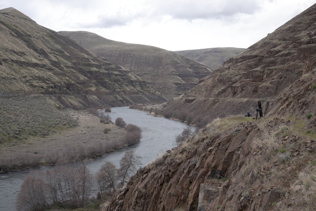
The majority of the Middle Deschutes route is gravel roads. Vehicle traffic can be busy from late spring to early fall but is quiet at all other times. The route lends itself to customized rides that can be any distance as an out and back trip or as a shuttle. The more isolated and scenic section is from Sherars Falls to the downstream end where the road terminates at Macks Canyon (a distance of 18 miles). Throughout the route the river flows through a narrow canyon with occasional rock cliffs. It is mostly grasslands with a border of trees along the river.
A number of campgrounds are scattered along the route for those who want to make it an overnight trip. None of the campgrounds have water and some are nothing but a gravel area with an outhouse. The campground at Macks Canyon is the most scenic.

Hood Mountain Loop

Length: 21 mile
Climbing: 2700 feet
Maximum elevation: 2000 feet
Surface: 49% unpaved road, 30% paved road, 22% paved bike path
The Hood Mountain Loop (not to be confused with Mount Hood) is a route just east of the town of Hood River that has something for everyone. Starting at the trailhead for the Twin Tunnels State Park and going counterclockwise, you ride through orchards on a paved road that turns steep and then shifts to gravel. A short side trip takes you to an overlook of the valley. Imagine the natural meadow below full of wildflowers (come back in the spring for those). On a clear day you get views of the Hood River valley, the Columbia Gorge, and Mount Hood.
The gravel road traverses a ridge and eventually make the long drop down to the town of Mosier. Grab a drink at Randonnee Coffee or a meal at Mosier Company and then head back to the start on the Twin Tunnels Trail. The Twin Tunnels Trail is restored section of the Columbia River Historic Highway and is a paved bike path. And yes, there is a tunnel.
Snow can linger along the high ridge in mid-winter so be prepared to turn around if your timing is off.
Klickitat Loop

Length: 44 miles
Climbing: 2800 feet
Maximum elevation: 2000 feet
Surface: 57% unpaved rails-trail, 43% paved road
The Klickitat Trail is a rails-trail route starting in Lyle, Washington, that follows the river, jogs onto pavement outside the town of Klickitat for a few miles, and then hops back on the rails-trail for the long climb up to the Centerville Highway. Take the highway back to Lyle or backtrack on the rails-trail. This route could be any length you want when ridden as an out and back.
Just a few miles out of Lyle you cross the Klickitat River gorge. The river is squeezed tight by vertical basalt cliffs. Native American fishing platforms angle precariously over the water. Further upstream the route follows the west side of the river through forest and grasslands. An occasional lone apple tree mark old homesteads that once bordered the railroad tracks. The route crosses the river and then follows a stream up through solitary hills and ends on the Centerville plain. While only 2000 feet in elevation, the plain has a reputation of being an ice box and snow might require turning back somewhere along the way.

Fifteenmile Loop – Long
Length: 42 miles
Climbing: 3100 feet
Maximum elevation: 2600 feet
Surface: 76% paved road, 24% unpaved road
This route goes up Eightmile Creek, crosses over to the east, and then comes down Fifteenmile Creek, leaving you with the feeling that the early pioneers in this area failed at coming up with interesting place names. At first glance, the brown wheat fields of winter seem bleak. But you might find the open sky, rodent-obsessed hawks, and the two rushing streams mesmerizing.
Park in front of the historic Petersburg School to start this journey. Check the snow level ahead of time to do this long version – the high point is 2600 feet. It's an ambitious ride because of its length and the 3100 feet of climbing. Scroll below for a less ambitious version of this ride.
Three quarters of this ride is on paved roads with hardly any traffic. The landscape has few farm homes that are still occupied. While it's always been wheat country, vineyards are beginning to crop up. Nevertheless, while riding on a winter day, it's hard to imagine this area ever being anything but barren. Come back in the spring when the wheat fields and vineyards have greened up and you'll have a different perspective.

Fifteenmile. Photo: Daniel Sharp
Fifteenmile Loop – Short
Length: 32 miles

Fifteenmile. Photo: Chip Andrus
Climbing: 1900 feet
Maximum elevation: 1400 feet
Surface: 88% paved road, 12% unpaved road
This is a shorter version of the Fifteenmile Loop described above and the maximum elevation is only 1400 feet so it may be better for days when the snow up higher hasn't yet melted. A higher percentage is paved road. Only 4 miles is gravel surface.
It has the same feel as the long loop – empty and peaceful.
Note
Surface types are delineated on the Ride with GPS maps with gravel roads shown in red, paved roads in black, unpaved rails-trail in purple, and paved bike path in yellow.