


Hood Tier Loop
Anaxshat Passage
what’s up with the name: ‘Anaxshat’?
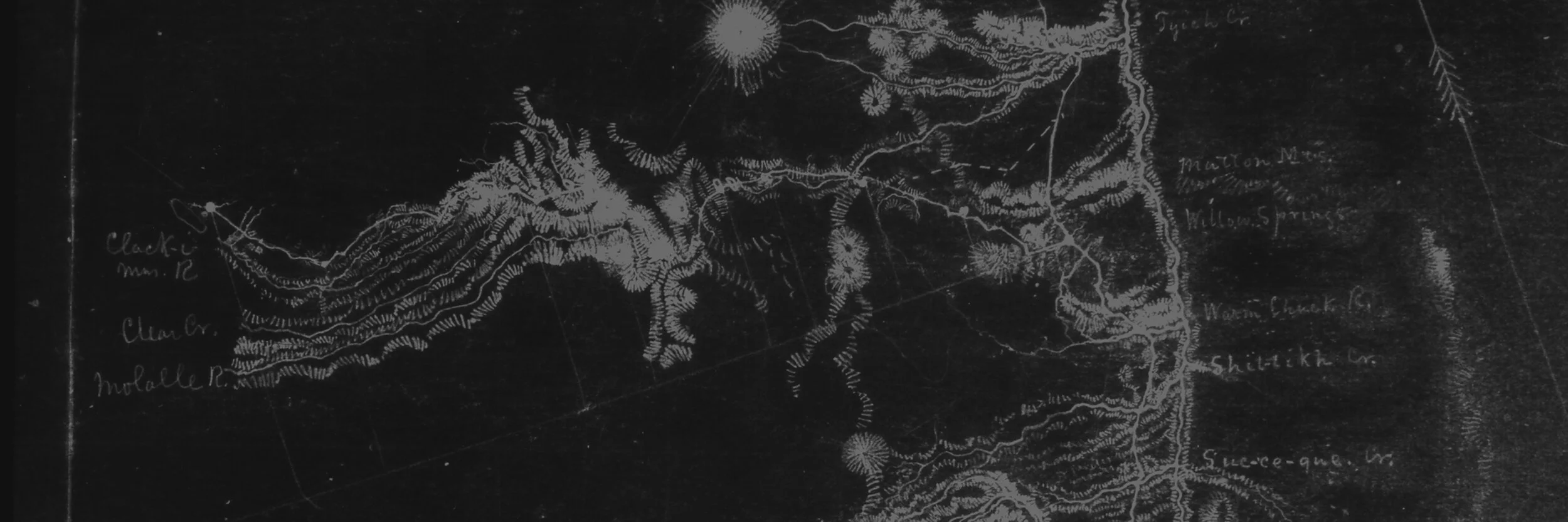
So what’s up with the name, ‘Anaxshat’? As the Oregon Trail became a major emigrant route in the mid 1800’s the available pastures along Mount Hood’s Barlow Trail and Lolo Pass were over-grazed making a long, hard journey even more difficult. Lieutenant Henry Abbot—a topographical engineer—was hired to find a suitable alternate route with potential for a future railroad. He enlisted the help of a young local indigenous man by the name of Sam Anaxshat.
Native people in this region would use ridge lines to access meadows and hunting grounds in the high country, as well as for trade routes with other tribes in central and eastern Oregon. Up and down the Willamette Valley these same people would frequently light controlled burns to make foot travel easier, encourage camas growth (a staple food source), and deer to linger in hunting grounds. Sam had travelled this route through the Clackamas River watershed once before and agreed to take Abbot’s whole outfit along the treacherous passage. This route is named in honor of Sam Anaxshat’s knowledge of the local terrain.
Learn more about the trails and history of this area on the Trail Advocate website.
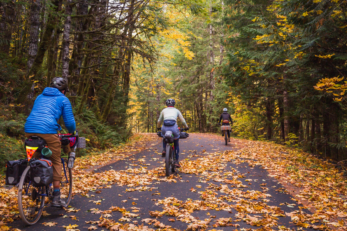
Pedal your way through massive old growth, past bubbling blue pools, around alpine lakes, and along an indigenous explorer’s route on the Oregon Timber Trail. The Anaxshat Passage embodies the trails and backcountry landscapes of the Hood Tier, all easily accessible over a long weekend from the Portland metro area and geared towards a less-experienced mountain biker.
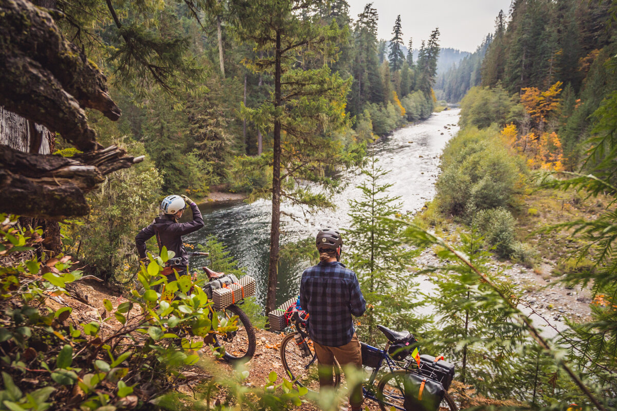
The Oregon Timber Trail’s Hood Tier traverses parts of the historic Skyline Trail—a precursor to the Pacific Crest Trail—from the base of Mount Jefferson towards Mount Hood. These verdant forests and countless spring-fed streams converge into one of the Willamette Valley’s mightiest watersheds: the Clackamas River. Estacada, less than an hour from downtown Portland, is the gateway to these endless forested mountain slopes and river rapids. Eventually, as you travel upstream from this old logging town, you’ll reach the Oregon Timber Trail and are left with a choice: north to the Columbia River Gorge or south all the way to California?
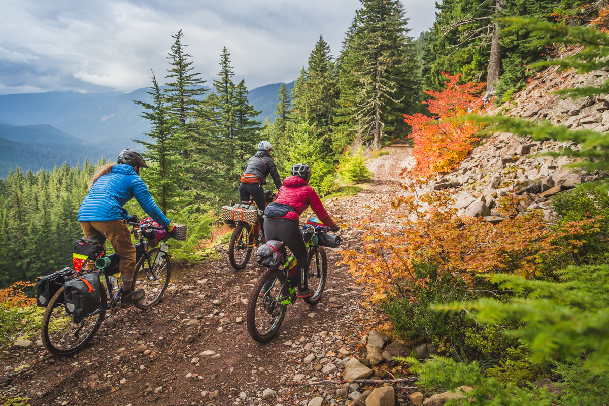
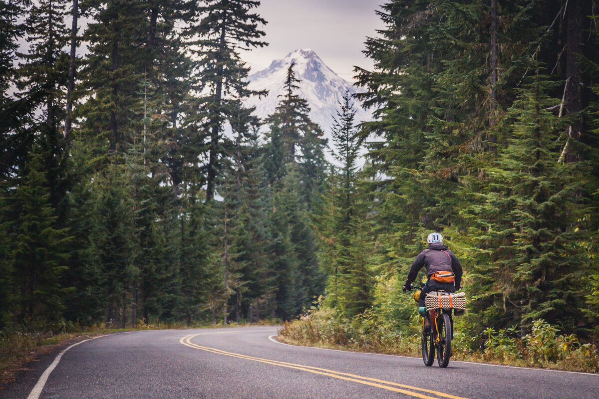
The Anaxshat Passage route explores this corridor and samples a bit of everything: meandering singletrack through giant firs along the Clackamas River banks, smooth pedaling on backroads, views of majestic Mount Hood, an alpine lakeshore trail, and a rough and tumble jeep road piercing the vast expanse of the Roaring River Wilderness.
This Hood Tier Loop was developed with a partnership between the Oregon Timber Trail Alliance and Oregon’s Mount Hood Territory to provide more riders the experience of the Oregon Timber Trail’s Hood Tier through the gateway community of Estacada. It is a stunning loop of beginner trails and quiet roads over the course of a long weekend.
Download the map on Ride With GPS and ride this Hood Tier Loop. ➜
Or continue reading the route guide below…

At a glance
Start/End: Estacada, OR
120 miles
9,840’ elevation gain
3-4 days
47% paved
40% dirt road
13% singletrack
95% rideable
5/10 physical difficulty
2/10 technical difficulty
Season: June through October
Highest Point: 4,635’
Day by Day
If you plan on a four-day trip you’ll be looking at about 30 miles, a little singletrack, and a nice campground at the end of each day. Sure you could squeeze it into three or even two days, but we think it’s worth a slower, exploratory pace.
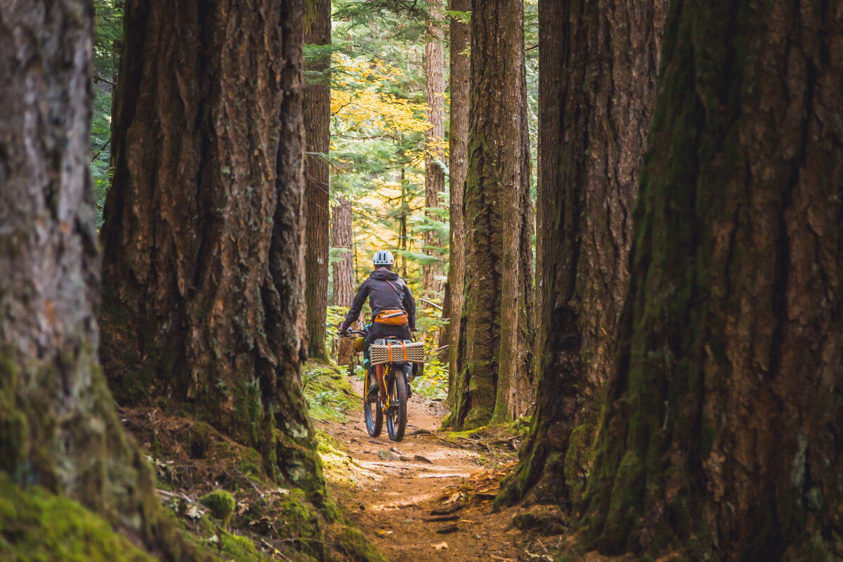
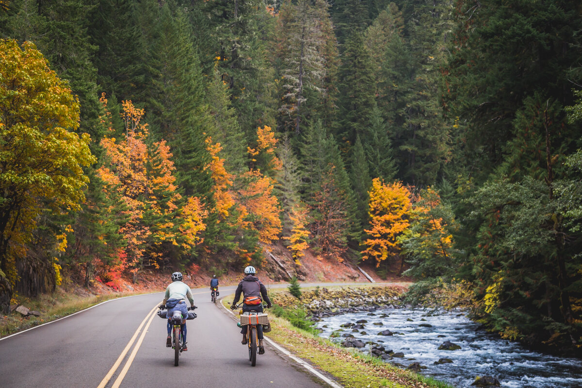
Embark on your journey heading east out of town on highway 224, soon you’ll leave the busy road and follow the carfree Faraday Road along a scenic series of reservoirs. Eventually you’ll rejoin 224 and follow it deep into the Clackamas River valley to Three Lynx where you'll get a taste of some climbing and a bit of gravel. Wrap up your day amongst the old growth along the Riverside Trail and camp at Sunset or Riverside Campground. Day one was about 35 road miles with 2,500’ of climbing—dip your tired dogs in the river and recoup for the big climb tomorrow. [As of 2024 the Riverside Trail is unrideable due to the fire. Instead, stay on the paved road.]
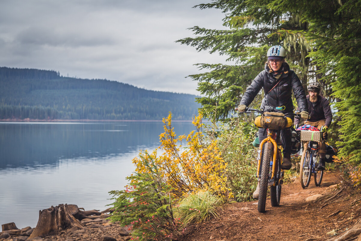
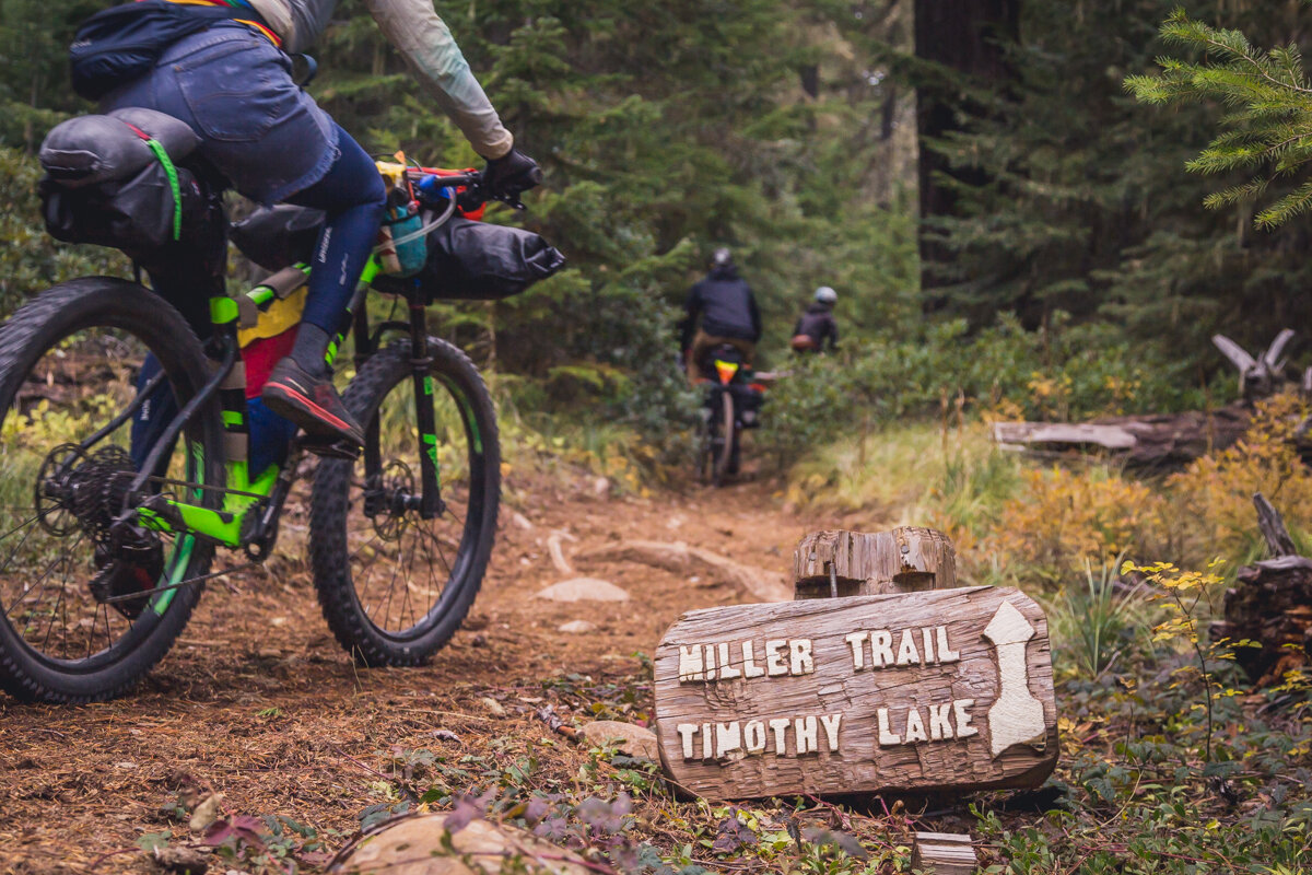
Day two finds you continuing upstream for about 10 miles and then beginning your gravel ascent in earnest for another 10 miles. Take your time and take in the views as you leave the valley floor: keep your eyes open for Mt Jefferson peeking out to the south. Soon you’ll regain the pavement along what used to be the Skyline Trail, a precursor to today’s Pacific Crest Trail. Depending how much ooompf you have left, it’s another 10-15 rolling miles to your campsite. Summit Lake is just off the route and the quietest campground, Clackamas Lake is next with stunningly clear waters, and if you decide to push on for the trails and views at Timothy Lake. Timothy Lake can be crowded in the summer.
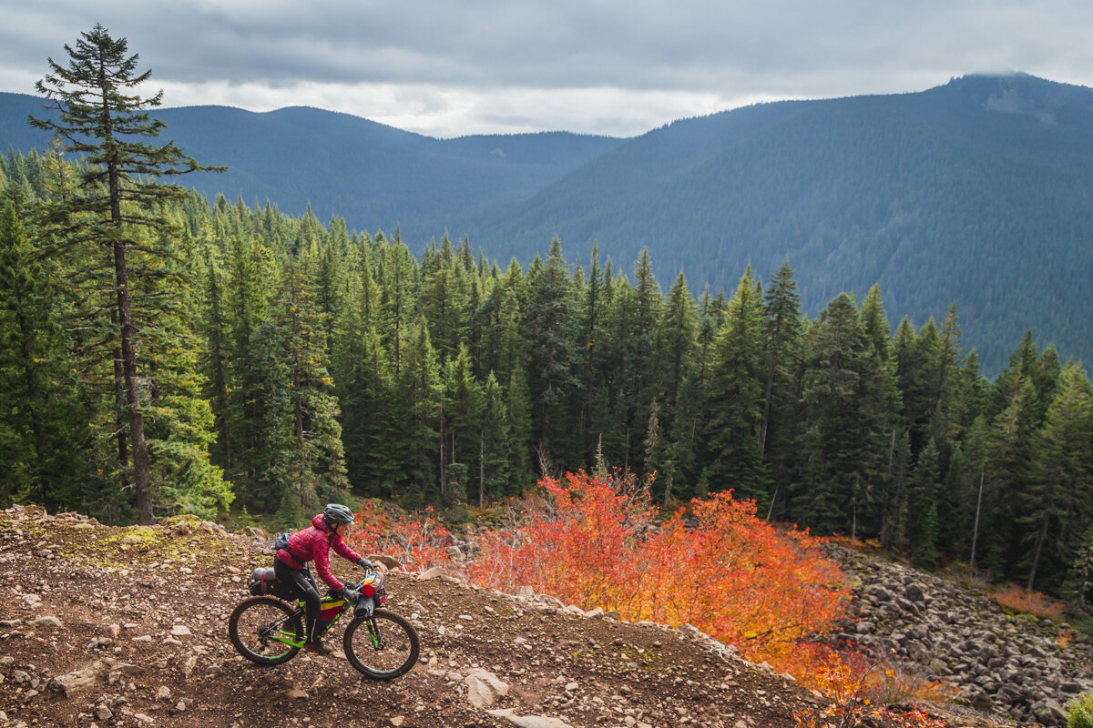
On the third day you continue your ascent skyward for about 15-20 miles to High Rock and the beginning of the infamous Abbot Road. After leaving Timothy Lake you’ll be following in the footsteps of Sam Anaxshat and Lieutenant Abbot’s expedition. If you want to make this day a short one, there’s a primitive campground and spring here, or keep pushing on into the Abbot Road corridor where other dispersed sites lay.
Take in the scenery as you begin your final day of the trip. Abbot Road winds in and out of the forested ridgeline and talus slopes offering the expansive views you’ve earned after climbing out the river valley far below. This leg is rough in spots, but not particularly technical. The Tumalo Alternate branches off to the right after 10 miles and the main route begins to descend in earnest. After almost 20 miles of descending you’ll rejoin your first day’s route at Faraday Road where it’s a quick pedal back into Estacada for burgers and pints at the pub.
Options
You can ride this route in either direction but it’s much better counter-clockwise in our opinion. The singletrack sections are relatively flat in either direction and the road climbs are much mellower if you follow the river upstream and return via the Abbot Road ridgeline.
If you’re a more confident mountain biker we highly recommend the Tumala Mountain Alternate indicated. (see the POI at mile 93.7) After about 9 miles along Abbot Road take a right on Old Baldy Trail #502 to Fanton Trail #505 for a bonus rugged singletrack leg. You’ll exit on NF4613 with a grin on your face. Head left/south and descend on the road before rejoining the main route. This 11 mile alternate is considerably more technical, but fun and beautiful.
Lesson learned: Don’t try to rush things, there’s lots to stop and look at.
logistics
Highlights
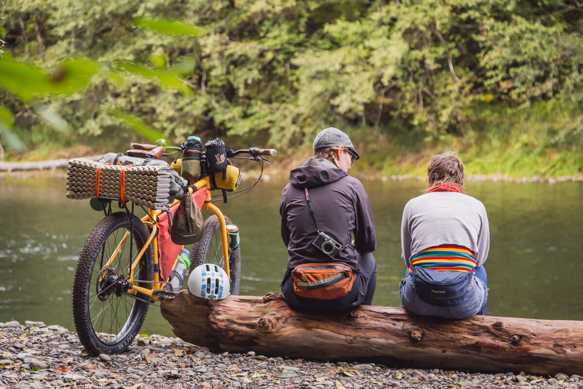
The Clackamas River is abound with both fishing and swimming holes—and you can even detour to Bagby Hot Springs for a hot soak.
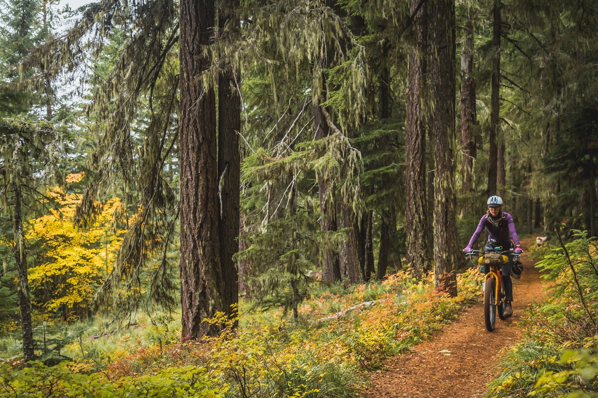
The Riverside Trail #723, the first singletrack section, is a hidden gem. It winds through looming old growth firs on a mossy velveted path.
Timothy Lake is popular for a reason: forested lakeshore campsites with picturesque views of Mt Hood’s snowy slopes.
After a long climb, High Rock is a welcome resting point with 360º views.
Abbot Road threads through the Roaring River Wilderness along Sam Axanshat’s and Lieutenant Abbot’s historic ridgeline route. You’ll marvel at how they managed to traverse this terrain without a road and a train of pack horses.
If your MTB skills are up for the challenge, the Tumala Mountain Alternate is well worth it.
How do I get there?
Estacada is the start and end of this route (as well as the Cascading Rivers Scenic Bikeway if you prefer to stay on the pavement) and offers free overnight parking at the city hall right on highway 224. It’s a quick 40 minute car trip from Downtown Portland and about a 90 minute bus ride from the central city. There’s also convenient bike-in campsites at Milo Mciver State Park just outside of town if you want to add a couple days and ride from Portland.
Is this route for me?
The Oregon Timber Trail is an awe-inspiring adventure but let’s be honest: it’s long and intimidating! On average it takes thru-riders about three weeks to complete the entire journey. And its backcountry nature through a variety of rugged landscapes means there’s miles of unmaintained trails and steep hike-a-bike ascents. The Anaxshat Passage route, on the other hand, is for those of us who only have a few days and maybe not as much experience (or penance for suffering) riding a heavily-loaded bike on technical trails.
The trail sections are perfect for beginner to intermediate-level riders and not mandatory: there’s easy detours if you prefer to stick to roads. There’s also frequently situated campgrounds and water sources abound so you can plan to ride it over 3, 4, or 5 days. That being said, it’s still a long 120 miles with a considerable bit of climbing: 10,000’ is no joke. Make sure your bike is comfortable and you’ve put some hours in the saddle before tackling this ride.
What bike should I ride?
We recommend a hardtail or rigid mountain bike with a minimum of 2” wide tires. None of the riding requires a dedicated mountain bike, but Abbot Road is quite rocky and you’ll be grateful for the cushion that wider tires provide. This route is also quite remote so the most important thing is that your bike is in good working order and it’s comfortable for you. You don’t want your body or your steed to break down and leave you stranded.


Navigation
Navigating your way through remote and frequently unsigned roads and trails is often the most challenging part of bikepacking. The Ride With GPS Ambassador Route map shown here is accurate and the best way to navigate this route. Download the Ride With GPS app on your phone and learn how to save routes for use without a cell signal. You can also export the GPS file to another device from the Ride With GPS website. Always carry a paper map in case your electronics fail. Paper trail maps are available from the Mount Hood National Forest office in Sandy and the National Geographic Trails Illustrated map #820 also covers this region.
Did we mention there’s no cell service for almost the entire route? You won’t be able to text your friend to pick you up, check google maps, or even post on Instagram! Make sure you are confident in your navigation skills before venturing out.
Camping
There are numerous campgrounds along the Clackamas River and Timothy Lake. Dispersed camping is also permitted in most places in the National Forest, though along this route camping is allowed only in established campgrounds from Estacada until beyond the Ripplebrook Ranger Station at mile 30.
Water
Finding potable water is easy in most campgrounds for the first ⅔ of this route, as well as limitless fresh streams to filter from. After leaving Timothy Lake water becomes more scarce as you gain altitude. There is at least one reliable cold spring bubbling out of Abbot Road’s talus slope at mile 88.6. Pack a water treatment system and carry 3-4 liters, which should be plenty if you camp near water.
Be considerate
While we’ve gone to lengths to choose low-traffic roads and rarely traveled areas; the Clackamas River corridor, Timothy Lake, and Abbot Road are all popular recreation areas with a variety of users—not to mention home to a stunning diversity of plant and animal life. Ride single file on roads and yield to other users along the trail—you’ll be surprised who you’ll meet and what you’ll learn with a friendly ‘Hello.’ Practice the Leave no Trace principles and tread lightly where you ride and camp.
Wait, what is bikepacking?
Simply, bikepacking is just backpacking with a bicycle. Many choose to do it on paved or dirt roads, and others prefer singletrack mountain bike trails. The Oregon Timber Trail focuses on the latter, but this route in particular de-emphasizes the trail portions. Bikepackers ride all types of bicycles depending on the terrain, and strap their camping gear to their bikes with a variety of specialized bags.


Do:
Smile and say hi—you’ll likely run into hikers, dirt bikers, fishermen, campers, equestrians, families, offroaders, and maybe even a sasquatch or two.
Pack a fishing pole if you have the time.
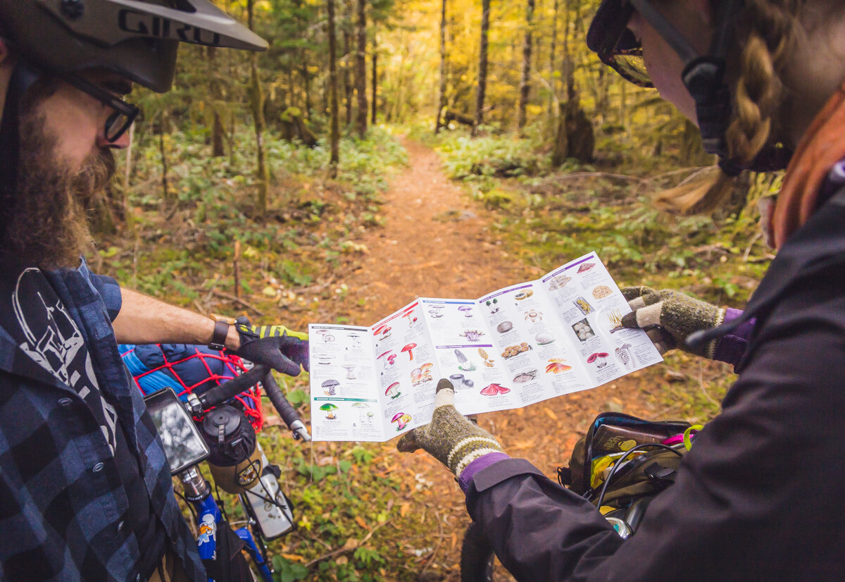
Keep an eye out for huckleberries in the summer months.
Stop by Clackamas River Growlers for a pint after your journey.
Don’t:
Try to rush your trip, there’s lots to stop and marvel at.
Bring a road bike—although there’s lots of pavement, Abbot Road is seriously chunky.
Get a late start from camp, the Abbot Road ‘descent’ takes a deceptively long time.
Resources
Mount Hood National Forest
(503) 630-6861
Clackamas River Outfitters
(503) 586-3241
Ripplebrook Camp Store
(503) 834-2322
Sandy Bicycle
(503) 826-1070
River City Bicycles
(503) 233-5973
Red Fox Motel
503-630-4243
Wonser Woods Estate
503-260-3703

